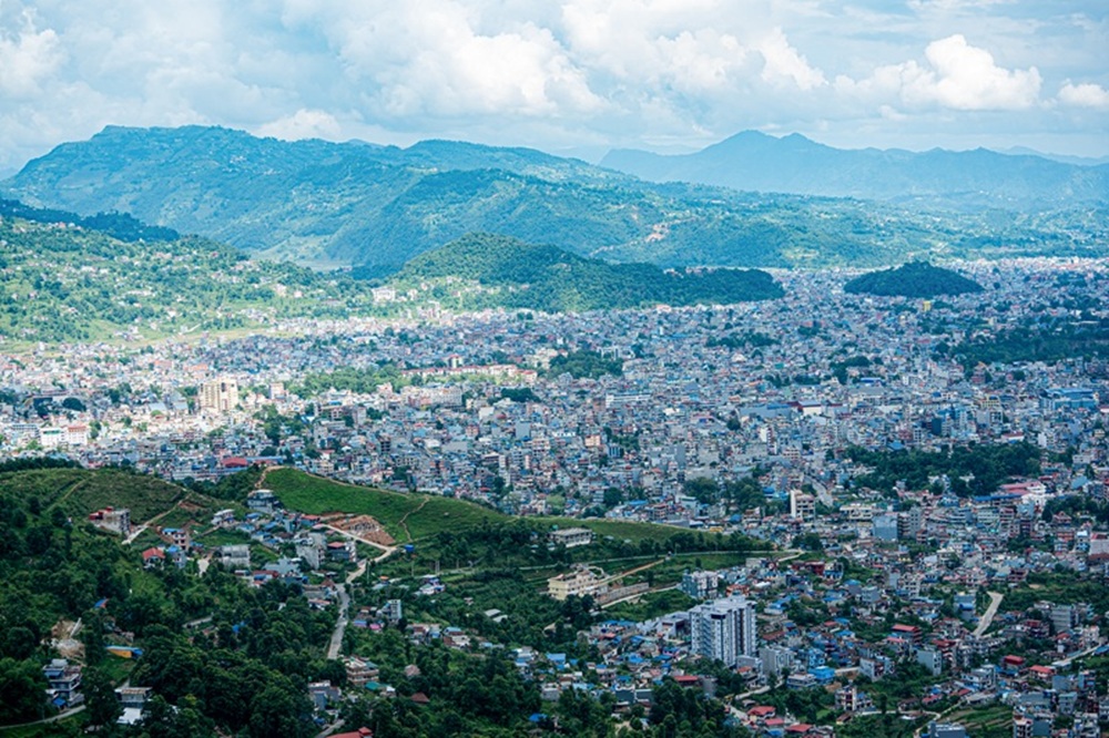
Kathmandu
Thursday, June 11, 2026


BHOJPUR: Among the rows of photographs of tourism destinations from Bhojpur district displayed in various places, there is one location that is never missed. Its name is written as: Sawa Waterfall (Sawa Jharna). However, the locals living around that waterfall do not even understand the word ‘jharna’ (waterfall). They call it ‘chhanga’ (cataract). They refer to that waterfall as ‘Sawa Chhanga’ (Sawa cataract)
In Nepali literature, the variation of words and accents within the same language is called regionalism or provincialism. In the regional dialect of the local native Bantawa Rai speakers, the word ‘Jharna’ does not exist. Children do not understand the word ‘Jharna’ taught in schools. They only understand ‘Chhanga’.
In that region, there are places named Chhanga Pakha, Chhanga Dobate, Chhanga Lam, Chhanga Ukalo, Ghatte Chhanga, Teen Chhango, and Siddhema Chhanga. The idiom “Like a buffalo looking at a waterfall” (Ranga le chhanga here jasto) is highly popular in that area. However, in the photographs promoting the district’s tourism, the word used by educated folks—’Jharna’—is found instead of the words from local speech.
Sawa Chhanga is located on the Sawa River, which flows from Hansapokhari in Ward No. 1 of Temkemaiyum Rural Municipality, Bhojpur, separating Pangkhaang and Sawa villages of the same ward.
Many years ago, the waterfall was neglected by the local villagers and remained in a disfigured state. People from other areas traveling to Maiyum would visit it occasionally. They liked the waterfall.
With the passage of time, an awareness began to grow among the villagers that the waterfall is also an asset to the village. It was included in the list of beautiful natural sites in Bhojpur district. Its photographs started appearing in places where people from the district headquarters gather. Promotion through photographs has indeed begun. It has also started appearing sporadically on social media.
Waterfalls everywhere
There are three waterfalls at the same spot in Sawa Chhanga. They do not have separate individual names. The two waterfalls located on the Sawa River are called the Big Cataract (Thulo Chhanga) and the Small Cataract (Sano Chhanga). The small waterfall is right on the trail. The waterfall situated directly above it is called the big waterfall. About 20 meters southwest of the small waterfall, a small stream comes to merge. That stream is called Koktuwa. Before merging into Sawa, the Koktuwa jumps down from a waterfall about 50 feet high. It falls directly onto the trail.
Since locals do not visit, tourists do not reach there, and it does not fall on the way to anywhere else, who would come making the waterfall their final destination? On top of that, there is no tourism infrastructure at all.
The geography of that area is somewhat steep. Because the Sawa River flows along a slope, dozens of small waterfalls look like streams of white foam by the time it reaches the bottom of Sawa village and merges with the Pikhuwa River. In addition to this, there are Ghatte Chhanga, Siddhema Chhanga, and Change Chhanga on the tributaries of the Pikhuwa River near Sawa.
In most Kirati languages, including Bantawa, ‘Wa’ means water. The final letter of the names of most streams and rivers in the hilly regions of Koshi Province contains ‘Wa’. Around Sawa Chhanga, there are streams and creeks named Koktuwa, Pikhuwa, Khoyyuwa, Bumkhuwa, Hingkhuwa, Sangentuwa, and Tuyuwa. Every single one of them has some kind of waterfall.
The more promotion, the more overshadowed
Although this sub-heading sounds contradictory, this is exactly what seems to be happening in the context of Sawa Chhanga—it remains overshadowed despite being promoted. In the past, it was a custom to take cattle and buffaloes from almost all houses in the village to the pastures (Kharkas) in the high hills. Most of the people from the former Timma VDC-3 living on this side of the Sawa River used to commute between their cattle sheds and houses using the waterfall trail. Everyone’s pasture-land was at the top of Sawa village. The trail to go there and come back also belonged to the waterfall. The main trail for traveling towards Maiyum also belonged to the waterfall. Since one could reach Hansapokhari directly from this trail, villagers used to advise people coming from outside to follow this path.
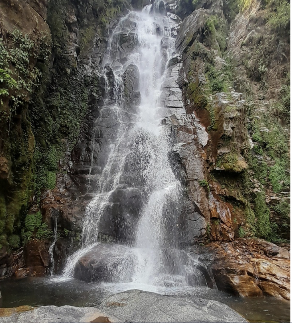
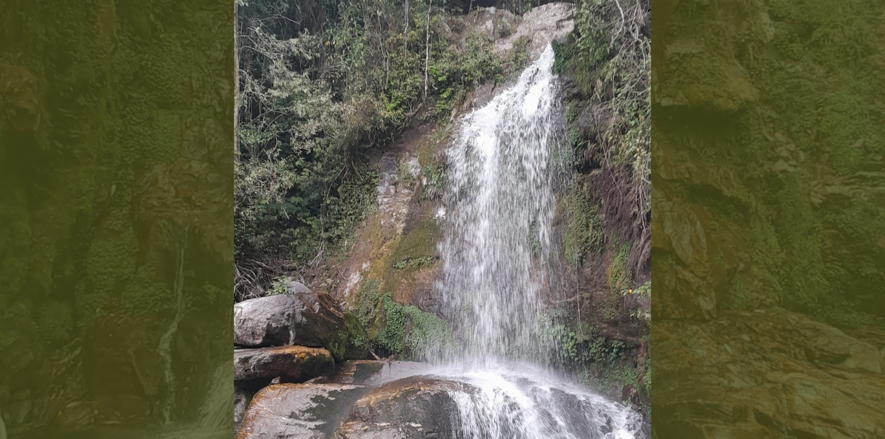
Sawa Waterfall in Temkemaiyum Rural Municipality-1, Bhojpur.
After being included in the Mundum Trail, Maiyum became the main attraction of this trekking route. A campaign was launched to develop the villages surrounding the Mundum Trail as buffer zones and entry points to make them tourism-friendly. The Setibagar-Suntale road reached much lower than Sawa Chhanga. Homestays came into operation in Sawa village. The walking trail leading directly from Sawa village to Hansapokhari was upgraded. Stone steps were built in difficult places.
Meanwhile, people started using the old route to reach Maiyum directly from above Pangkhaang, which was less frequented in the past. One does not even have to cross the Sawa River this way. The practice of keeping many animals and moving them from pasture to pasture like before decreased drastically in the village. The practice of traveling far for farming also came to an end. There was no one left to commute to the pastures, cattle sheds, and pasture-lands via the waterfall trail.
Since those going to Maiyum split into one group going straight up from Sawa and another group going straight up from Pangkhaang, nobody reached Sawa Chhanga anymore. This time, after the road tracks that recently opened from Pangkhaang Bikhe through Gufa Hekkule to Gokele became a bit better, those going to Maiyum travel straight through.
But since locals do not visit, tourists do not reach there, and it does not fall on the way to anywhere else, who would come making the waterfall their final destination? On top of that, there is no tourism infrastructure at all.
It appears that not only the locals but the entire district is involved in promoting Sawa Chhanga. However, no one seems to have thought that a good walking trail is needed to get there. Forget about maintenance for years, the old trail has not even been cleaned. The trail coming from the Pangkhaang side remains damaged by landslides in various places. The bushes on both sides of the trail have turned what was once a wide road into a narrow walking track.
If Sawa Chhanga is truly to be made a tourism center, the three old trails coming from Pangkhaang Chokkolima, from the top of Sawa, and the one leading out to Chipchipe must be repaired and made good. It would be appropriate to build a picnic spot near the waterfall. Places to stop and admire the view, and spots to take photos must be constructed.
The horizontal trail coming from the top of Sawa barely fits the sole of a foot. That too has been diverted from the middle and led towards the big waterfall.
Steps have been installed at the place where one reaches the big waterfall. The existence of the previous main trail going towards the small waterfall has been erased. As for the trail leading straight uphill from the waterfall to Chipchipe, the very existence of the path is gone in most places.
Even where it exists, it is completely covered by barberry bushes and ‘Panajhyal’ plants.
The time has not yet come to expect people to travel from afar and spend money just to see Sawa Chhanga. If anyone sees three waterfalls in one place like Sawa Chhanga while walking along a path, they might linger for an hour or an hour and a half.
Tourism promotion does not suffice merely by praising and advertising the beauty of a place or object. The main things are geographical accessibility and physical infrastructure.
If Sawa Chhanga is truly to be made a tourism center, the three old trails coming from Pangkhaang Chokkolima, from the top of Sawa, and the one leading out to Chipchipe must be repaired and made good.
It would be appropriate to build a picnic spot near the waterfall. Places to stop and admire the view, and spots to take photos must be constructed.
Furthermore, it would be even more wonderful if a new adventure route could be built from the road going to Sawa, heading uphill along the Sawa River itself, passing through the waterfall, and going straight up to Hansapokhari. However, for that, vision and a large budget are required.
The main thing for the promotion of Sawa Chhanga is that the unhealthy competition and stubbornness between the residents of Sawa and Pangkhaang must end. The people of Sawa want those going to Maiyum to take the steps straight up the Sawa route and return via the same path.
The people of Pangkhaang want them to go via the Pangkhaang route through Hekkule and return through the same. In this situation, nobody is paying attention to Sawa Chhanga.