Kathmandu
Sunday, June 21, 2026


From deadly earthquakes and monsoon floods to landslides and glacial lake outbursts, Nepal’s disaster record reflects a recurring cycle of natural hazards intensified by geography, climate change, and preparedness gaps—leaving tens of thousands dead and exposing deep long-term vulnerabilities
KATHMANDU: Nepal sits at the collision point of two of the earth’s great tectonic plates, wrapped in steep terrain, drenched by one of the world’s most intense monsoons, and home to glaciers that are rapidly changing under a warming climate.
It is a country of extraordinary beauty and extraordinary risk. Experts rank it among the most disaster-prone nations on earth, and the numbers bear that out.
Over 43,500 people have died from natural disasters in Nepal from 1983 to April 2026, with 496 of those deaths recorded in just the twelve months between April 2025 and April 2026 alone.
The question for Nepal has never been whether a disaster will come. It is always when, and how prepared the country will be when it does.
Why is Nepal considered one of the most disaster-prone countries in the world?
Nepal’s extreme vulnerability to natural disasters comes from a combination of factors that are almost uniquely unfortunate when stacked together. The country sits directly above the boundary where the Indian tectonic plate is pushing northward under the Eurasian plate, generating relentless seismic pressure and producing some of the world’s most violent earthquakes.
Nepal’s terrain drops from the highest mountains on earth down through steep mid-hills and into flat river plains within a remarkably short horizontal distance, which means that water, rock, and soil can travel at dangerous speeds when disturbed.
The monsoon dumps intense rainfall over this unstable terrain for four months every year, regularly triggering landslides, flash floods, and river flooding. On top of all this, Nepal is a low-income country where a large proportion of the population lives in houses built without earthquake-resistant engineering, often on steep slopes or river floodplains.
According to the Nepal Disaster Risk Reduction Portal, Nepal ranks 11th globally in terms of earthquake risk. The 2021 Population Census found that 99 percent of Nepal’s wards, meaning practically the entire country, face some form of disaster risk.
Floods threaten 63.6 percent of wards and landslides threaten 59.7 percent. The hazard is not a possibility in Nepal. It is a near-certainty.
What role does the monsoon play in Nepal’s disaster cycle?
The monsoon is the defining seasonal event in Nepal’s disaster calendar. It typically arrives in mid to late June, usually beginning in the eastern parts of the country, and it runs through September, bringing roughly 80 percent of Nepal’s annual rainfall in those four months.
The country’s rivers, many of them fed by both monsoon rain and Himalayan snowmelt, swell rapidly and push enormous volumes of water and sediment through narrow mountain gorges and down onto the plains.
Everest Base Camp on a Stormy Day. File photo
The Terai, Nepal’s flat southern plains bordering India, regularly floods during peak monsoon, inundating farmland and communities. The mid-hills face landslides and flash floods. Mountain valleys experience debris flows. The pattern repeats every year, claiming lives every year.
Between 2015 and 2024, Nepal recorded 8,418 disaster incidents triggered by monsoon-related causes, affecting 56,705 families, damaging 36,479 houses, and destroying 195 bridges. In 2024 alone, 495 people died due to monsoon-related disasters.
In the monsoon season of 2025, above-average rainfall was forecast across most of the country, with some provinces expecting 55 to 65 percent more rain than the seasonal average. The monsoon is not a surprise. It comes every year. What changes is how prepared communities and governments are when it arrives.
How severe are floods and landslides in Nepal, and why do they occur so frequently?
Floods and landslides are arguably Nepal’s most persistently deadly hazard, and they kill people every single monsoon season without exception. Nepal’s mid-hill terrain is geologically young and inherently fragile, with steep slopes, loose soils, and rock formations that are still being actively shaped by tectonic forces.
When the monsoon arrives and dumps intense rainfall over this terrain, the water saturates slopes rapidly, removing the friction that holds soil and rock in place. The 1993 landslides and debris flows are a particularly devastating example from recent history, killing 1,259 people across 44 districts and causing property and infrastructure losses worth more than Rs 47 billion at the time.
Deforestation dramatically worsens the problem, as tree roots bind hillside soils together, and their removal leaves slopes exposed. Unplanned road construction, which has accelerated across Nepal’s hills in recent decades, cuts into unstable slopes and regularly triggers cascades of debris, particularly during rain.
Between 2015 and 2024, landslides were the single deadliest category of monsoon disaster in Nepal, responsible for 1,296 deaths out of 2,317 total monsoon fatalities recorded over that decade. On a single weekend in October 2025, landslides in Ilam district in eastern Nepal killed 37 people, with entire villages swept away overnight.
What is the tectonic reason Nepal faces such powerful earthquakes?
The Himalayas, and Nepal’s catastrophic earthquake risk, are the direct product of two of the earth’s largest tectonic plates crashing into each other. The Indian plate has been moving northward and driving beneath the Eurasian plate for tens of millions of years, and it continues to do so today at a rate of roughly 40 to 50 millimetres per year. This collision built the Himalayan mountain range over geological time, but the process is far from finished.
The immense pressure building along the fault zone, known as the Main Himalayan Thrust, accumulates stress for decades and sometimes centuries before releasing it in catastrophic bursts of energy. Every time that happens, Nepal shakes.
The shallowness of many Himalayan earthquakes makes them particularly destructive, as shallow quakes send their energy more directly upward into the ground surface where people live and buildings stand.
Seismologists have identified what they call a seismic gap in certain sections of the Himalayan fault where stress has built up for a very long time without a major release, meaning large earthquakes are not just possible in future but are considered highly probable.
Research published in 2013 estimated that on average, a magnitude 8 or larger earthquake occurs somewhere along the Main Frontal Thrust approximately every 750 to 870 years in the east Nepal region. That clock is always ticking.
What happened in the catastrophic 1934 Bihar-Nepal earthquake?
The earthquake of January 15, 1934 remains one of the most devastating in the entire history of South Asia. It struck in the early afternoon with an estimated magnitude of around 8.0 to 8.3, its epicentre located in eastern Nepal near the border with Bihar in India.
The shaking was felt from Lhasa in Tibet to Bombay, and from Assam to Punjab, covering a vast portion of the subcontinent. In the Kathmandu Valley, all three of the major historic cities, Kathmandu, Bhaktapur, and Patan, suffered severe damage, and more than 207,000 buildings were destroyed or damaged across Nepal.
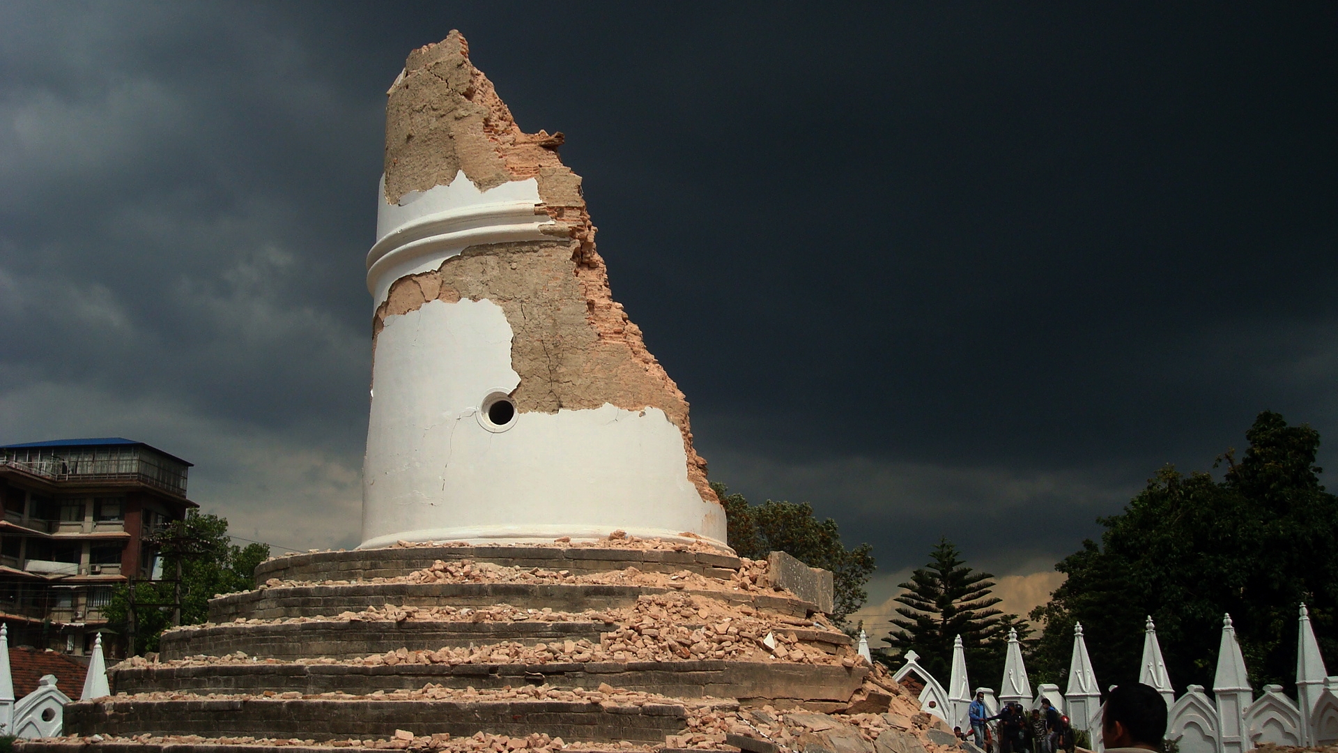
Dharahara, also called Bhimsen Tower, a nine-storey 61.88-metre tall tower, was destroyed after earthquake on 2015. Photo courtesy: WikiMedia
The town of Birgunj, which is today a major commercial hub right on the Indian border in what is now Madhes Province, was destroyed entirely. Death toll estimates vary across sources, but scholarly research places Nepal’s toll at approximately 8,500, with another 7,000 or more killed in Bihar, bringing combined fatalities to well over 15,000.
The disaster revealed how catastrophically the Kathmandu Valley’s soft, lake-sediment geology amplifies seismic shaking, a lesson that remained relevant and largely ignored for decades afterward. This earthquake was the deadliest Nepal had experienced in recorded history until 2015.
What happened during the 2015 Gorkha earthquake and why was it so devastating?
On the morning of April 25, 2015, a magnitude 7.8 earthquake struck central Nepal with its epicentre in Barpak, Gorkha district, approximately 85 kilometres northwest of Kathmandu.
It hit at 11:56 in the morning, which almost certainly reduced the death toll compared to a night-time strike, as people in rural areas were working outside rather than sleeping under fragile roofs. Even so, the destruction was overwhelming.
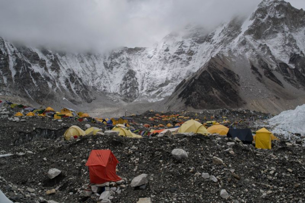
Around 9,000 people were killed and more than 22,000 were injured across Nepal, India, China, and Bangladesh. About 2.8 million people were displaced, and over 600,000 structures were either destroyed or damaged. The earthquake triggered a massive avalanche on Mount Everest, killing at least 22 people at base camp, making it the deadliest single incident in Everest’s recorded history.
Three UNESCO World Heritage Sites in the Kathmandu Valley, including Kathmandu Durbar Square, Bhaktapur Durbar Square, and Swayambhunath, suffered major damage. The iconic Dharahara tower, a nine-storey historic structure in Kathmandu built in 1832, collapsed, killing at least 180 people sheltering inside.
A major magnitude 7.3 aftershock struck on May 12, 2015, killing an additional 153 people. The total economic loss was estimated at around 7 billion US dollars, roughly equivalent to a third of Nepal’s entire GDP at the time.
What made the destruction in 2015 so much worse than it could have been?
Several factors combined to amplify the destruction far beyond what the magnitude of the earthquake alone would suggest. The earthquake was shallow, occurring at a depth of only about 8 kilometres, meaning its energy reached the surface with tremendous force.
The Kathmandu Valley sits on ancient lake sediments that behave like a bowl of jelly during seismic events, amplifying ground shaking significantly compared to areas built on solid bedrock. Approximately 86 percent of households in Nepal’s rural areas at the time were built from earthen, stone, and wood construction without any seismic-resistant features, meaning they were structurally incapable of surviving major ground motion.
Remote villages in mountain districts like Sindhupalchowk, Gorkha, and Rasuwa were almost completely flattened, and the terrain made reaching them by road nearly impossible, so rescue teams and relief supplies were severely delayed.
Security personnel conducting rescue operation during disaster. File photo
The scale of destruction was also compounded by the cascade effect: the earthquake triggered hundreds of landslides, which blocked roads and rivers, created dangerous lakes, and hampered emergency response for weeks.
In Sindhupalchowk district alone, the combined effect of both the April and May 2015 earthquakes destroyed 95 percent of houses.
What was the 2023 Jajarkot earthquake and what does it reveal about Nepal’s ongoing vulnerability?
On the night of November 3, 2023, an earthquake struck Jajarkot district in Karnali Province, western Nepal, shortly before midnight when people were asleep. Measured at magnitude 5.7 by most agencies, the quake killed 153 people and injured at least 375 more, making it the deadliest earthquake in Nepal since 2015.
About 62,000 houses were affected across 13 districts, of which over 26,000 collapsed. Nearly half of those killed were children, most of them sleeping when their homes caved in around them.
The earthquake exposed something important and painful: despite all the hard lessons of 2015, building practices in remote western Nepal had not meaningfully improved. Houses in Jajarkot and Rukum West were built in traditional styles without reinforcement, often on steep terrain, and they simply could not absorb the shock.
The 2023 earthquake also happened in an area that had received relatively little post-2015 reconstruction attention compared to the Kathmandu Valley and central Nepal.
The earthquake reminded the country and the international community that vulnerability is not concentrated in one place. It is spread across every remote hill district where people are building the same kinds of houses their grandparents built, because that is what they can afford.
What are glacial lake outburst floods and why is Nepal especially threatened by them?
A glacial lake outburst flood, known by its acronym GLOF, is one of the most dangerous and least predictable natural disasters Nepal faces.
As temperatures rise, the glaciers of the Himalayas are melting faster, and the meltwater collects in lakes held back by walls of loose glacial debris called moraines. These natural dams are unstable. When they give way, whether due to an earthquake, an avalanche, or simply the increasing weight of water, they release enormous volumes of water and debris that rush down river valleys at tremendous speed, destroying everything in their path.
Nepal has experienced at least 24 to 26 GLOF events in recent decades, and the risk is growing. As of now, 47 glacial lakes in Nepal are classified as potentially dangerous. In July 2025, a GLOF from the Purepu Glacier in Tibet sent floods down the Bhotekoshi River in Rasuwa district, killing at least 11 people and leaving 18 missing.
In August 2024, a glacial lake in the Everest region burst above Thame village, displacing at least 135 residents. In May 2025, two glacial lakes burst above a village in Humla, triggering flooding and a subsequent landslide.
A single major GLOF event can cause economic losses exceeding 100 million US dollars. A Green Climate Fund project worth 36 million US dollars has been approved to lower water levels in the four highest-risk lakes, but the broader challenge across Nepal’s hundreds of glacial lakes remains enormous.
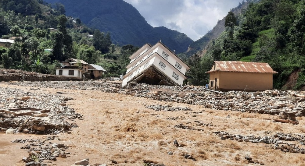
What was the Melamchi flood of 2021 and what made it unusual?
The Melamchi flood of June 15, 2021 was one of the most dramatic water disasters Nepal experienced in recent years, and it was unusual because of the chain of events that produced it. The Melamchi River in Sindhupalchowk district, central Nepal, had carried a hydroelectric and water supply project that had taken many years and considerable investment to build.
On that June day, a combination of heavy rainfall, changes at the snowline altitude, erosion in a glacial moraine, a possible breach in a natural glacial dam, and a series of landslides cascading along the valley all came together to release a massive surge of water and debris.
The flood destroyed at least 350 residential buildings, swept away six bridges, and damaged or buried enormous amounts of infrastructure. The Melamchi water project itself suffered serious damage. The World Bank and the Global Facility for Disaster Reduction and Recovery assessed the event as a compound disaster, meaning it was not caused by a single trigger but by several reinforcing factors happening simultaneously.
This is increasingly how Nepal’s disasters are occurring: not as isolated events but as cascades where one hazard triggers or amplifies another, making both prediction and response far more difficult than dealing with any single hazard in isolation.
How does deforestation make Nepal’s disasters worse?
Deforestation is one of the most significant human contributions to the severity of Nepal’s natural disasters, and its effects run through almost every category of hazard the country faces. Nepal’s forests, particularly in the mid-hill zones, act as a giant sponge and anchor for the land. Tree roots bind soil together and hold hillside slopes in place, absorbing rainfall and releasing it slowly into streams rather than allowing it to rush across bare surface.
When forests are cleared, the soil becomes loose and vulnerable. Heavy monsoon rain hits exposed ground directly, causing rapid runoff, erosion, and slope failure. Landslides on deforested slopes are measurably more frequent and more severe than on forested ones.
The loss of vegetation also reduces the ability of the landscape to absorb floodwaters in the Terai, worsening the severity of flat-land inundation. Nepal has made progress in community forestry over recent decades, and there has been genuine recovery of forest cover in some areas thanks to community forest management programs that are internationally recognised as successful.
However, illegal logging, encroachment, and unregulated road construction continue to strip slopes in vulnerable areas. Climate change is now adding another threat in the form of increased wildfires, which has been burning extensively across Nepal’s mid-hills in the spring months of 2026, stripping additional hillside cover just before the monsoon arrived.
Why do buildings keep collapsing in Nepal even decades after the risks became clear?
This is one of the most important and difficult questions in Nepal’s disaster story. The country has known about its earthquake risk for well over a century, and has had building codes in place for years, yet the majority of structures outside the major urban centres are still built without seismic reinforcement. The reasons are intertwined and difficult to separate.
The most fundamental is poverty. Building a house with proper reinforced concrete columns, beams, and earthquake-resistant design costs significantly more than building in the traditional way with stone, mud, and local timber. For rural families with very limited cash income, the traditional method is the only method they can afford. There is also the issue of enforcement.
Building codes exist on paper but are largely not enforced in rural municipalities, many of which lack the technical staff to inspect construction. Cultural familiarity with traditional building methods is another factor: people build the way their parents built because it has been done that way for generations.
After the 2015 earthquake, Nepal established a National Reconstruction Authority and received enormous international support to build back better. Progress was made, particularly in the most affected central districts. But the 2023 Jajarkot earthquake demonstrated that in western and remote Nepal, the vast stock of unreinforced buildings remains intact and vulnerable.
The gap between knowing what is needed and being able to implement it at scale across a poor, mountainous, poorly connected country remains very wide.
What are the other major floods and water disasters in Nepal’s history worth knowing about?
Beyond the Melamchi disaster, Nepal’s history is full of major flood and water events that caused enormous damage. The 1993 monsoon brought some of the worst flood and debris flows on record, claiming 1,259 lives across 44 districts and causing infrastructure losses of more than Rs 47 billion.
The great rivers of Nepal, including the Koshi, Narayani, Karnali, and Mahakali, are all perennial rivers fed by Himalayan snowmelt, meaning they carry vast volumes of water even before the monsoon adds its full weight. These rivers have burst their banks repeatedly throughout history.
In October 2021, the Mahakali, Karnali, and Seti rivers recorded their highest flows in decades due to unseasonal late monsoon rainfall, causing 88 deaths and leaving 30 people missing across Sudurpaschim Province.
In July 2024, Nepal recorded its heaviest single-day rainfall in 77 years of measurement at Dodhara Chandani in Kanchanpur, where 624 millimetres fell in 24 hours. That level of rainfall in that short a time overwhelms any drainage system or river channel.
In October 2025, intense flooding from concentrated monsoon downpours swept through parts of Ilam, Kathmandu, Rautahat, Bara, and Parsa, killing at least 47 people in a matter of days. Nepal also sits downstream of rivers that originate in Tibet, meaning that floods from glacial events across the border can arrive in Nepal with little warning, as happened repeatedly along the Bhotekoshi valley.
What does climate change mean for Nepal’s disaster future?
Climate change is not a distant threat for Nepal. Its effects are already measurable and already deadly. The average temperature in the Himalayas is rising faster than the global average, accelerating glacier melt and expanding the number and size of unstable glacial lakes.
Monsoon rainfall patterns are shifting, with some years bringing more concentrated extreme rainfall events rather than a steady seasonal spread, meaning that when the rain comes, it comes harder and faster than river banks and drainage systems can handle. Heat extremes are also being broken.
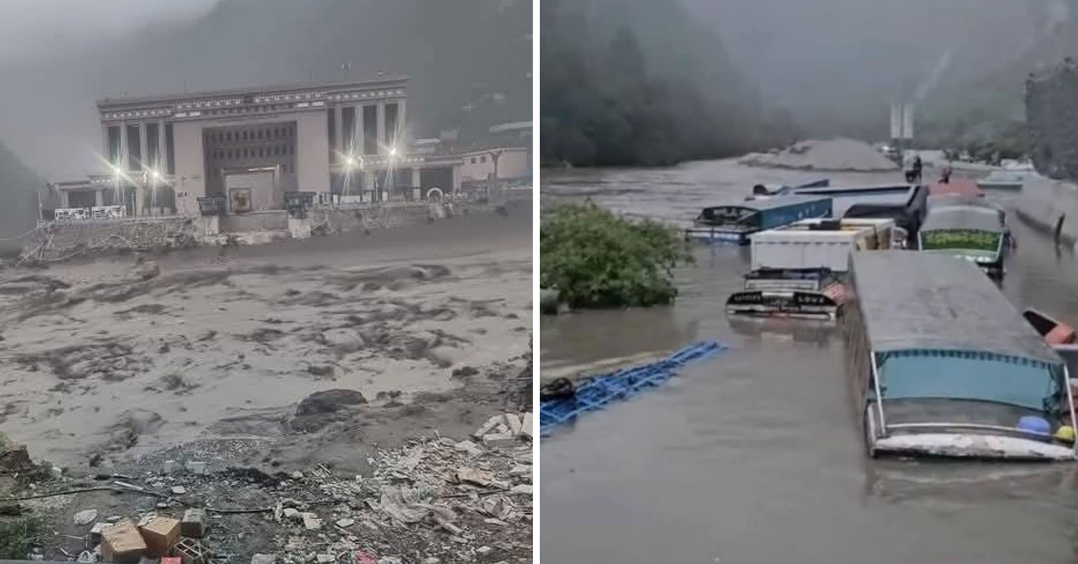
A massive flooding of the Bhotekoshi River in Rasuwagadhi swept away the Miteri Bridge (Friendship Bridge), a crucial trade link between Nepal and China. File photo
On May 30, 2024, Nepalgunj recorded 44.2 degrees Celsius, approaching the historical record for the country. The frequency of intense monsoon events is increasing. Experts studying the October 2025 flooding in Nepal noted that back-to-back severe monsoon seasons are consistent with climate change intensifying the hydrological cycle.
Meanwhile, the unpredictability of glacier behaviour above Nepal’s valleys is growing, with small glacial lakes that were previously considered low-risk now proving capable of catastrophic outbursts.
Nepal contributes almost nothing to global greenhouse gas emissions, yet it absorbs some of the most severe consequences of a crisis created primarily by industrialised nations. This is one of the starkest examples of climate injustice anywhere in the world.
What does the monsoon approaching in 2026 mean for Nepal right now?
As of the beginning of May 2026, Nepal is entering the weeks immediately before the monsoon season typically arrives. The pre-monsoon period, running from March through May, already brings its own hazards in the form of wildfires across the mid-hills and hailstorms and thunderstorms in the plains.
The monsoon itself is expected to reach Nepal’s eastern hills around mid-June and progressively cover the whole country over the following two to three weeks. The Department of Hydrology and Meteorology monitors rainfall and river levels across the country and operates a weather room that stays active around the clock throughout the monsoon.
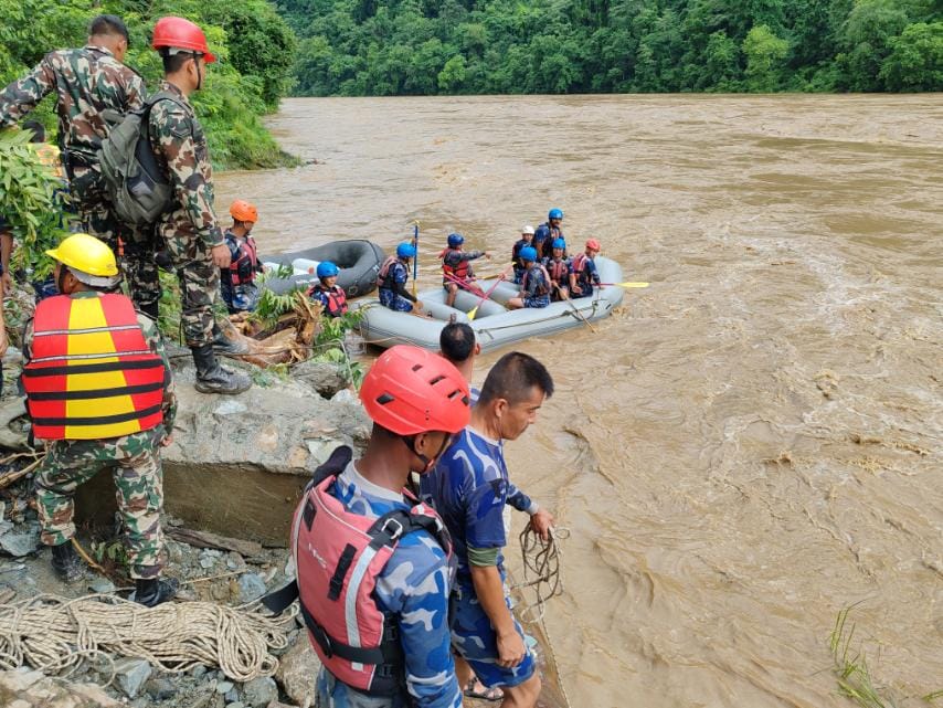
Citizens can access flood and disaster alerts through a toll-free number, 1155, as well as through SMS and voice message systems. The Nepal Army maintains rescue teams at helicopter bases with pre-positioned resources.
Local governments have been instructed to clear drainage systems, identify landslide-prone areas, and prepare temporary shelter locations.
In 2025, the monsoon season killed 140 people despite above-average rainfall, and authorities credited coordinated preparedness under the National Action Plan for Monsoon Preparedness and Response with keeping the toll lower than it might otherwise have been.
Whether 2026 follows a similar pattern depends heavily on how seriously local-level preparations are taken in the weeks that remain before the rains begin.
What is the economic cost of Nepal’s recurring disasters?
Nepal is one of the poorest countries in Asia, and its annual disaster losses represent a significant drag on a development process that is already difficult. The 2015 Gorkha earthquake alone caused damage and losses estimated at around 7 billion US dollars, roughly equivalent to one-third of the country’s entire GDP at the time.
Between January 2016 and April 2025, Nepal recorded nearly 50,000 disaster incidents according to data from the Disaster Risk Reduction Portal. The total economic losses from fires, landslides, and floods over that period exceeded Rs 33 billion.
Fire disasters, which include both structure fires and wildfires, accounted for nearly 75 percent of total losses during that period, reflecting how vulnerable Nepal’s closely built traditional settlements remain. Floods and earthquakes each contributed around 8 percent of total losses and landslides around 6 percent.
Beyond the direct losses in infrastructure, agriculture, and property, disasters impose enormous indirect costs on Nepal’s economy through disrupted tourism, damaged hydropower plants, destroyed roads that cut off trade and markets, and the deep psychological and social costs on affected communities.
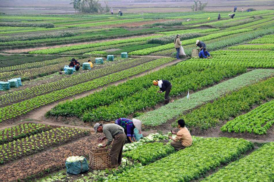
Agricultural disruption is particularly serious because Nepal remains a predominantly agrarian economy, and a bad monsoon flood year can destroy entire harvests and push families who were barely making ends meet into serious food insecurity and debt.
How does Nepal’s geography make search and rescue so difficult after disasters?
Geography that creates disaster risk also creates enormous barriers to responding to disasters once they happen. Nepal’s mountain districts are connected to the rest of the country primarily by narrow mountain roads that are themselves highly vulnerable to being cut off by landslides, flooding, or earthquake damage.
After the 2015 earthquake, entire districts were effectively inaccessible by road for extended periods. Rescue teams had to be flown in by helicopter, and the demand for helicopter flights vastly exceeded supply.
In the 2023 Jajarkot earthquake, rescuers and journalists noted that landslides blocked key roads near the epicentre, slowing the arrival of security forces, medical teams, and relief supplies.
Nepal has a limited fleet of rescue helicopters relative to the scale of its disaster needs, and private helicopters are increasingly brought into service under memoranda of understanding between the government and airline operators during major events.
The rugged terrain also means that remote villages often have no mobile phone signal, making it impossible to know what has happened to them in the immediate aftermath of a disaster. Communities that most need help are often precisely the ones hardest to reach.
This geography is not going to change, which is why investment in early warning, community-level first response training, pre-positioned supplies, and strategic rescue infrastructure is essential rather than optional.
What warning systems exist and how effective are they?
Nepal has been developing its disaster early warning infrastructure over recent years, though significant gaps remain. The Department of Hydrology and Meteorology operates a network of rain gauges and river level sensors across the country, and these feed data into a flood warning system that can send SMS alerts, phone calls, and voice messages to communities in projected flood paths.
The flood bulletin, when triggered, gives a maximum of three days lead time for communities to prepare or evacuate before rivers peak. An international Anticipatory Action Framework coordinated by OCHA and UN agencies provides pre-arranged financing and actions for flood-prone communities when a trigger threshold is crossed, meaning that cash and supplies can reach vulnerable households before a flood rather than after it.
However, coverage is far from complete. Many disaster-prone areas remain outside the reach of formal warning systems. In communities that do receive warnings, the time available is often only a few minutes before a flash flood arrives.
A 2020 Copernicus report assessed Nepal’s flood early warning system and found that even simple tools like sirens and SMS alerts can save many lives, but they need to be expanded, maintained, and paired with community training so that people know what to do when a warning arrives.
Landslide early warning systems are even less developed than flood systems, and glacial lake monitoring, while improving, still cannot reliably predict when a moraine dam might give way.
What has Nepal done in terms of laws and policies to manage disaster risk?
Nepal has built a fairly comprehensive legal framework for disaster risk management, even if implementation on the ground remains uneven. The Disaster Risk Reduction and Management Act of 2017 is the central legislation, accompanied by implementing rules from 2019, a National Policy from 2018, and a Strategic Plan of Action covering 2018 to 2030.
The Constitution of Nepal assigns disaster management responsibilities across all three tiers of government, from the federal level down through provincial governments and local municipalities. The National Disaster Risk Reduction and Management Authority, known as NDRRMA, is the primary coordinating body.
Specific strategies exist for forest fires under the National Forest Fire Management Strategy, for floods under the Water Induced Disaster Management Policy, and for monsoon preparedness under an annual action plan.
Nepal has also participated in the Sendai Framework for Disaster Risk Reduction, the international agreement under which countries commit to reducing disaster losses. However, experts consistently point out that legal frameworks are only as good as their enforcement and implementation, and Nepal’s general laws tend to prevail over more specific disaster-risk-focused regulations that often lack enforcement mechanisms.
The gap between policy on paper and practice in the field remains one of the most significant challenges in making Nepal genuinely safer.
What would it take to meaningfully reduce Nepal’s disaster deaths in the long term?
Reducing Nepal’s disaster deaths is genuinely possible, but it requires sustained effort across multiple fronts simultaneously rather than reactive response after each new disaster. Building codes need to be enforced outside the major cities, which means training and deploying enough qualified inspectors at the local government level and making earthquake-resistant construction financially accessible to rural families, potentially through subsidised materials or technical assistance.
Landslide risk requires serious investment in watershed management, including reforestation of vulnerable slopes and strict regulation of road construction in the steepest and most fragile hill areas. Flood early warning networks need to be extended to cover all high-risk river corridors, and the communities they serve need regular drills and practical training so that warnings translate into saved lives rather than confusion.
Urban planning in growing towns needs to prohibit construction on river floodplains and known landslide zones, something that is frequently ignored today. Climate adaptation needs to be woven into every sector, from agriculture to hydropower to urban planning, because the disaster baseline is shifting as temperatures rise and rainfall patterns change.
Community-based disaster management, where local people are trained and empowered as the first line of response rather than waiting for external rescue, has been shown to be one of the most cost-effective approaches. None of this is impossible.
It requires political will, sustained international support, and the recognition that Nepal’s disaster deaths are not simply the inevitable result of geography. They are the result of choices, and different choices can save lives.