Kathmandu
Monday, June 29, 2026


The southwest monsoon arrived six days behind schedule, bringing heightened risks of floods, landslides and glacial lake outburst floods. This explainer examines what to expect, the regions most at risk, and how authorities are preparing for the months ahead
KATHMANDU: The southwest monsoon surged across Nepal’s eastern border and established itself throughout Koshi Province on June 19, arriving roughly six days behind the forty-year normal entry date of June 13.
The Department of Hydrology and Meteorology issued heightened weather alerts on June 27 for very heavy rainfall across hilly and mountainous regions of Koshi Province through the coming days, with thunderstorm and lightning warnings extending across multiple eastern and central provinces.
The late arrival sets the stage for a monsoon season that is expected to fully blanket the entire country by early July, introducing a four-month window during which Nepal’s geological and hydrological vulnerabilities manifest in floods, landslides, and cascading disasters.
National Monsoon Preparedness and Response action plans have been activated, with Kathmandu Metropolitan City identifying 128 flood-prone locations and pre-positioning temporary shelter facilities in parks and schools across the city. Seasonal rainfall patterns suggest that while monsoon delivery will eventually reach all districts, the distribution may be uneven, with above-normal rainfall in some zones offset by below-normal amounts in others.
The late arrival carries both advantages and risks. Delayed water inflow may stress agricultural zones dependent on moisture for monsoon cropping early in the season, slow reservoirs used for hydropower from beginning to refill on schedule, and compress the window for accumulated discharge before peak flow pressures arrive. It also means that dry-season fires consuming hillsides in the pre-monsoon period had already thinned vegetative cover in many mid-hill zones before the rains began, eliminating one protective layer against landslide mobilization.
Meteorological forecasts for the full June-September monsoon period indicate that western Nepal, including Lumbini, Karnali, and Sudurpaschim provinces, face elevated risk of below-normal rainfall, while eastern and central zones are expected to receive near-normal to above-normal totals. Climate models suggest that 55 to 65 percent of districts in Lumbini, Madhesh, Koshi, Gandaki, Karnali, and Sudurpaschim provinces carry measurable probability of receiving below-average rainfall over the full monsoon term.
Meanwhile, above-normal temperatures are expected to persist across most of Nepal, a combination that could trigger localized intense rainfall events interspersed with dry periods rather than steady, distributed seasonal rainfall.
What is the precise status of monsoon advancement across Nepal as of late June 2026?
As of June 29, the monsoon system has fully established itself across all of Koshi Province, all of Madhesh Province, and all of Bagmati Province, as well as portions of Gandaki Province and the eastern regions of Lumbini Province. This represents coverage of approximately the eastern two-thirds of Nepal’s territory.
The remaining western regions, comprising western portions of Gandaki, all of Karnali, and all of Sudurpaschim provinces, remain under the partial influence of westerly winds and local circulation patterns. The Department of Hydrology and Meteorology forecasts that monsoon winds will extend into the remaining territories within three to five days, achieving complete national coverage by July5.
Current weather patterns show generally cloudy conditions across the hilly and mountainous regions and Terai of affected zones, with light to moderate rainfall concentrated in localized areas. The Terai regions of the unaffected western provinces remain mostly clear, with relatively dry conditions persisting. However, the meteorological division’s latest special bulletins issued on June 27 warned of a temporary intensification phase.
Heavy to very heavy rainfall is forecast for localized areas in the hilly and mountainous regions of Koshi Province over the subsequent 48-72 hours, with moderate rainfall likely in parts of Madhesh. Thunderstorms accompanied by lightning are expected at scattered locations across Koshi, Bagmati, and Gandaki provinces, with additional risk in Terai zones of Koshi and Lumbini.
Wind speeds may reach levels capable of causing localized damage to agricultural crops and temporary structures. This intensification represents the monsoon system establishing firm control rather than a aberrant weather event, but it introduces concentrated risk in a window when both public preparedness and institutional response systems are ramping up operations.
Why did the monsoon arrive later than average this year, and what do climate models suggest about the full seasonal pattern?
The 2026 late monsoon arrival reflects the current state of global atmospheric circulation patterns, influenced by the developing phase of the El Niño Southern Oscillation. When El Niño strengthens, the Indian Ocean warming pattern and tropical atmosphere circulation dynamics can delay monsoon onset in South Asia.
Department of Hydrology and Meteorology attributed the six-day late arrival specifically to this global climate oscillation state. However, the late onset does not guarantee a weak or unusually dry monsoon. In fact, historical analysis of previous late-monsoon years shows mixed outcomes.
The 1972, 1982, 1987, 1992, 1997, 2002, and 2009 monsoons, all of which arrived earlier than normal, produced variable seasonal totals. Some years saw above-average rainfall, while others delivered below-average totals despite their early starts.
The International Centre for Integrated Mountain Development has issued specific projections for 2026 indicating that much of Nepal will receive below-normal rainfall over the June-September monsoon period. This projection appears counterintuitive given the early start, but it reflects the understanding that monsoon onset and monsoon intensity operate on different mechanisms.

An early onset may reflect one atmospheric configuration, while seasonal total reflects accumulated moisture delivery over the full four-month term. Climate models run by ICIMOD project that parts of Lumbini Province face significant probability of receiving 20-30 percent less than their seasonal normal. Western Karnali and Sudurpaschim face similar deficits.
The probability of below-normal rainfall reaches 55-65 percent across multiple districts in these provinces. Central and eastern Nepal shows somewhat higher probability of receiving near-normal to slightly above-normal rainfall. These spatial disparities have profound implications. Western districts, already facing climate-driven water stress and depleting groundwater in lower elevations, could experience agricultural production losses if monsoon fails to deliver expected moisture.
Eastern districts, with higher probability of above-normal rainfall, face elevated flood and landslide risk. The combination is neither uniformly wet nor uniformly dry but rather a complex patchwork that favors eastern regions while stressing the west.
What specific risks does late monsoon arrival pose for Nepal’s glacier systems and high-altitude water dynamics?
The Himalayan glaciers feeding Nepal’s major river systems respond to moisture arrival patterns, seasonal temperature changes, and the cumulative heat and water balance over spring, summer, and autumn months. A late monsoon shifts the timing of moisture input but does not automatically decrease total moisture received.
More significantly, delayed moisture arrival means that atmospheric conditions over the high mountains may remain clearer and drier longer into June, potentially allowing greater incident solar radiation to reach glacier surfaces. The theoretical prediction could include accelerated melt during June due to increased direct solar heating before monsoon clouds arrive.
However, once the monsoon establishes, clouds can trap outgoing radiation, potentially maintaining higher nighttime temperatures that affect both surface ablation and internal glacier dynamics. The net effect on glacier balance remains uncertain.
What is more concrete is the implication for glacial lake hazard. Nepal currently tracks forty-seven glacial lakes classified as potentially dangerous, with water levels controlled by unstable moraine barriers vulnerable to overflow or outburst. Late monsoon arrival means that these lakes begin refilling and rising in water level later than the historical norm in some scenarios, but rapid filling can still occur once rains arrive.
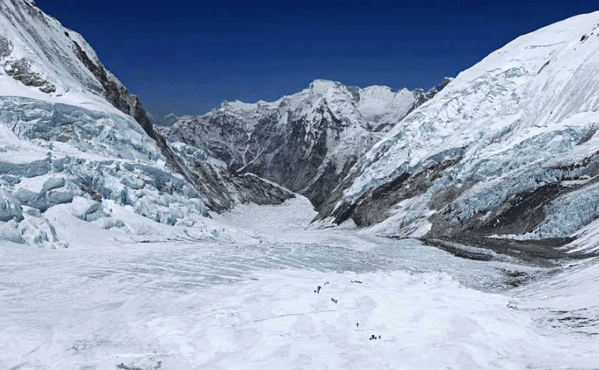
Declining snow levels in the Hindu Kush Himalayan glaciers region. Photo courtesy: ICIMOD
The risk window for glacial lake outburst flooding may shift. The Bhotekoshi River corridor in Rasuwa district, where a July 2025 GLOF killed at least eleven people and left eighteen missing, remains particularly vulnerable. The glacial lakes feeding that system would be receiving monsoon recharge starting in late June rather than earlier.
The Department of Hydrology and Meteorology and specialized glacial monitoring programs have been put on alert regarding high-altitude lakes, but early warning capability for specific lakes remains limited. A major GLOF event from one of the vulnerable forty-seven lakes could claim hundreds of lives depending on downstream population concentration and topography.
How are Kathmandu Metropolitan City and other urban areas specifically preparing for monsoon flooding risks this year?
Kathmandu Metropolitan City has identified 128 locations within the city where flooding poses documented risk during peak monsoon. These locations derive from historical analysis of where water accumulation and inundation occurred during previous high-rainfall events and where topography creates natural drainage convergence points.
Ward-by-ward analysis has identified particular vulnerability zones. Ward 16 faces threat from overflow of the Samakhushi and Bishnumati rivers, with approximately 1,600 households at risk of displacement. Ward 26 has nearly 1,200 households in vulnerable locations. Wards 3 and 4 each contain approximately 1,000 households exposed to flood risk.
The city has designated fifty-one parks, twenty-eight open spaces, and eighty-seven schools as temporary shelter facilities with basic amenities for displaced populations. Ward offices have been instructed to identify households at highest risk and conduct preliminary registration to accelerate shelter allocation if evacuation becomes necessary.
Drainage systems are being cleared of accumulated silt and debris in the weeks preceding peak monsoon. The KMC’s drainage network, which handles both stormwater and some sewage flows, frequently becomes overwhelmed during intense rainfall events because it was designed for historical precipitation regimes now being exceeded more frequently due to climate change.

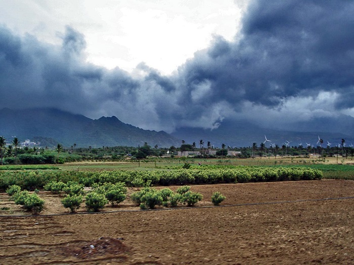
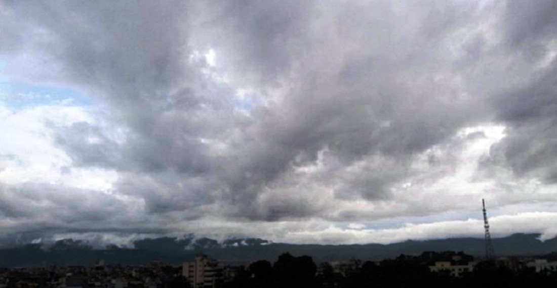
A striking pre-monsoon sky over Kirtipur as dense clouds blanket the Kathmandu Valley right before a storm. File photo
Pre-monsoon cleaning extends the drainage system’s capacity but cannot fully address the underlying infrastructure deficit. Private construction in flood-prone areas continues despite official zoning restrictions, adding new exposed populations. The city has also established coordination mechanisms with provincial and federal disaster management authorities to enable rapid information flow and resource mobilization if major flooding occurs.
Early warning alert systems provide population notification through SMS, voice messages, and community sirens in vulnerable areas when river levels reach critical thresholds. However, flash floods, which can arrive within minutes of intense rainfall in hill valleys, cannot be adequately warned against with current lead time. Response preparedness is focused on post-event search and rescue capacity rather than advance evacuation.
What landslide risks escalate during the monsoon season, and why are the mid-hill regions particularly vulnerable?
Landslides represent the single deadliest monsoon-related hazard in Nepal. Over the decade spanning 2015-2024, landslides accounted for 1,296 deaths out of 2,317 total monsoon-related fatalities, making them responsible for roughly 56 percent of all documented monsoon deaths. The terrain vulnerability is geological and hydrological.
Nepal’s mid-hill ranges, spanning elevations from roughly 1,500 to 3,000 meters, are composed of relatively young rock formations and sediments still actively shaped by tectonic forces. The slopes are steep, the soils shallow, and the weathering rates high. When monsoon rainfall saturates the soil column, water removes the frictional forces holding soil and rock in place. On slopes inclined more than thirty degrees, this saturation creates conditions for mass failure.
The frequency and severity of landslides in these zones dramatically exceed those in the high mountains or lower plains. Deforestation of mid-hill slopes compounds the vulnerability geometrically. Trees and their root systems bind soil together and allow slow infiltration of rainfall into underlying layers. Once forests are cleared for agriculture, human settlement, or road construction, slopes become exposed.
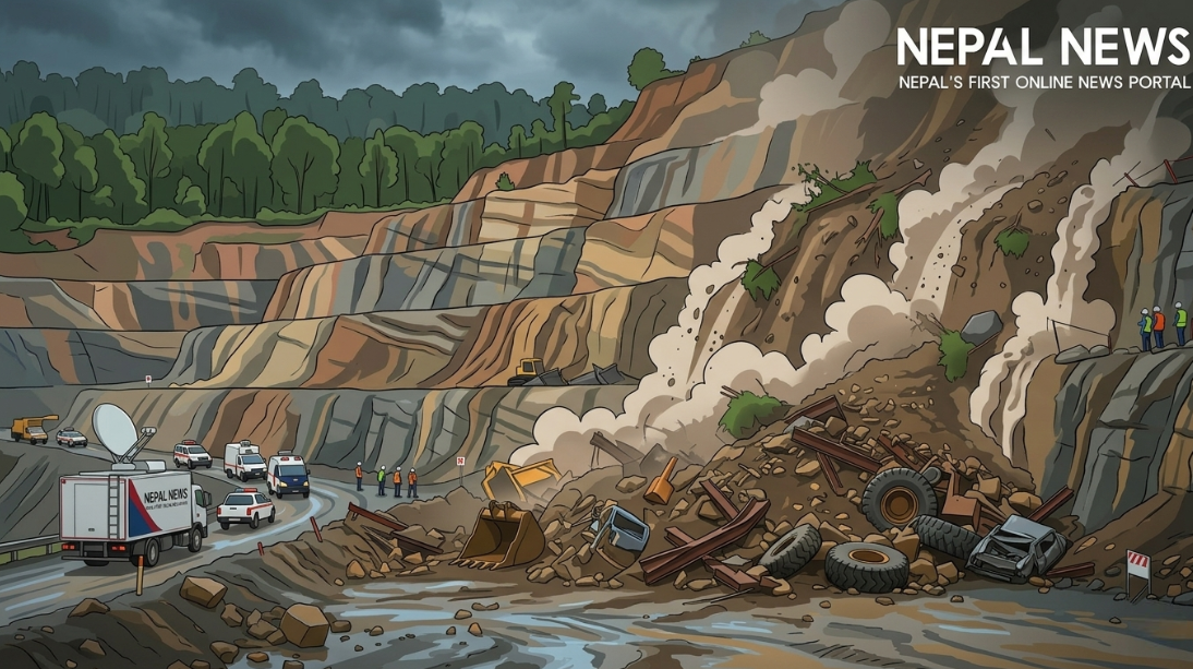
The same rainfall that might soak into forested ground now runs rapidly off bare surfaces, concentrating flow and energy and triggering erosion and shallow debris flows. Unplanned road construction accelerated across Nepal’s hills in recent decades. These roads, often built with inadequate drainage and cut aggressively into hillsides, create massive zones of exposed unstable material. During monsoon, these constructed scarps frequently trigger cascades of debris that block water courses, bury structures, and cut off ground access.
The October 2025 event in Ilam district is instructive. A single weekend of moderate to heavy rainfall triggered multiple landslides that killed thirty-seven people and swept away entire villages. Ilam district sits in the eastern mid-hills, terrain structurally and geologically similar to dozens of other vulnerable districts.
The 2025 event demonstrated that even moderate rainfall events, interpreted individually, can be catastrophic when they saturate slopes already at the edge of failure. Pre-monsoon wildfires, which burned extensively across Nepal’s mid-hills during March, April, and May 2026, removed additional vegetation cover that would have otherwise provided slope stability immediately preceding the heavy monsoon rains. This compounds landslide risk for the current season.
What role does climate change play in altering Nepal’s monsoon hazard profile?
The Himalayan region experiences warming at roughly double the global average rate, a phenomenon termed High Mountain Asia amplification. Mean temperatures in Nepal’s mountains have risen measurably over recent decades, with impacts cascading through water and weather systems. Warming drives three primary mechanisms affecting monsoon hazards.
First, higher temperatures accelerate glacier melt, increasing peak streamflow volumes and extending the melt season. When monsoon rainfall arrives atop accelerated glacier discharge, river channels handling already high volumes from snowmelt face additional input and frequently exceed bankfull capacity.
The 2024 floods that devastated parts of Kanchanpur recorded 624 millimeters of rainfall in twenty-four hours, the heaviest single-day measurement in seventy-seven years of records. That rain fell into rivers already charged with monsoon flow and glacier discharge simultaneously.
Second, warming destabilizes existing glacial lakes by reducing the stability of moraine dams. As temperatures climb, permafrost within and beneath moraines thaws. Water percolation through damaged moraines accelerates. The structural integrity of natural dams declines. GLOF events, once roughly predictable to timing and magnitude, have become more frequent and less predictable. Nepal logged at least twenty-four to twenty-six GLOF events in recent decades. The probability is rising.
Third, warming alters atmospheric dynamics in ways that concentrate rainfall into more intense events. Rather than monsoon delivering steady rain across four months, climate models and observations suggest an increasing tendency toward concentrated extreme rainfall events interspersed with drier periods. This pattern is harder on drainage systems and slope stability than steady rainfall. A system designed to handle 100 mm over ten days can manage the flow. The same system cannot handle 150 mm in twenty-four hours.
The climate change component to Nepal’s monsoon hazard profile does not originate in Nepal but rather in the global accumulation of greenhouse gases driven primarily by industrialized nations. Nepal contributes roughly 0.03 percent of global emissions yet absorbs monsoon-related hazards worsened by global warming. This represents perhaps the starkest manifestation of climate injustice on Earth’s geography.
How effective are current early warning systems for floods, and what gaps remain?
Nepal operates a flood early warning network based on a distributed system of rainfall and river level sensors operated by the Department of Hydrology and Meteorology. When rainfall measurements at ground stations or river level gauges fed by satellite data indicate that flooding thresholds are likely to be exceeded, automated alerts are generated and distributed to at-risk communities through SMS messages, voice calls, and community sirens in certain locations. The lead time provided by this system varies from a few hours to approximately three days depending on where the triggering river measurement occurs and downstream travel time.
In broad terms, a flood bulletin issued with twenty-four to forty-eight hours lead time allows communities to prepare, move valuables to higher ground, and potentially evacuate if informed about flood risk. For flash floods generated by intense rainfall on steep hillside terrain, the lead time may be measured in minutes. The Mahakali River in western Nepal, the Koshi in the eastern Terai, and the Karnali in central regions all have monitoring stations providing data for flood warning. However, coverage is far from complete. Many high-risk river valleys in remote hill districts lack any monitoring infrastructure.
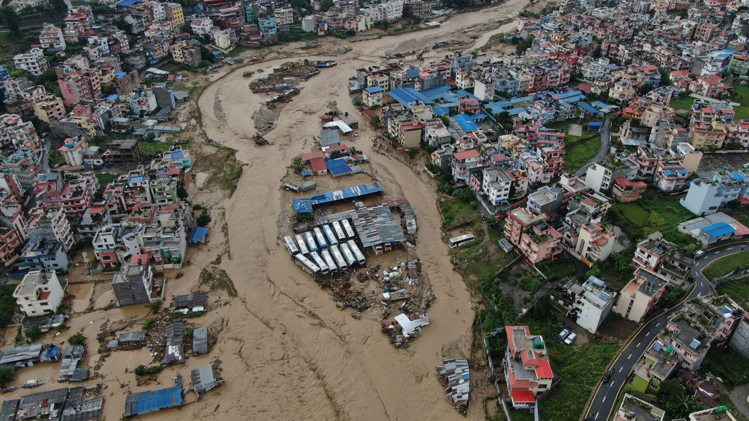
Drone view of the flood and inundation in the Nakkhu River in Lalitpur following the heavy rainfall on September 28, 2024. Photo: Gopen Rai.
A river valley with no gauge station provides zero lead time for downstream flooding. The system is also dependent on functional communication infrastructure. SMS alerts presume mobile phone coverage and charging capability. In communities hit by heavy rainfall or floods that damage power infrastructure, phone charging becomes impossible within hours. Communities in areas with unstable mobile network coverage may not receive alerts at all.
Testing of the system during 2025 monsoon indicated that the combination of forecast rainfall alerts, flood bulletins, and community training could save many lives. However, experts consistently note that the early warning system, even optimally functioning, cannot provide the lead time needed for floods generated by extremely intense, geographically concentrated rainfall.
A convective thunderstorm dropping 400 millimeters over two hours over a single catchment can generate a flash flood within thirty minutes. No satellite or ground instrument can predict such localized storms with useful lead time.
Preparedness systems must therefore combine early warning infrastructure with community-level first response training, pre-positioned rescue equipment, and strategic planning for high-risk communities that cannot be evacuated even if flooding is anticipated.
What is the National Monsoon Preparedness and Response Action Plan, and how substantially does it reduce mortality compared to uncoordinated response?
Nepal has developed, under the National Disaster Risk Reduction and Management Authority, a National Monsoon Preparedness and Response Action Plan. The plan formalizes roles and responsibilities across all three tiers of government, federal to provincial to local, for preparing for and responding to monsoon hazards.
It includes pre-monsoon activities such as drainage clearing, identification of vulnerable populations, evacuation drills, and positioning of emergency supplies. It establishes protocols for data collection and real-time coordination during active disaster events. It includes pre-arranged financing mechanisms for rapid deployment of cash and supplies to affected communities.
An Anticipatory Action Framework, coordinated with international humanitarian agencies, pre-positions supplies and authorizes release of cash assistance to vulnerable populations once specific rainfall or flood trigger thresholds are crossed. The 2025 monsoon season, which killed 140 people despite above-average rainfall, provides a data point for assessing the plan’s effectiveness. The 2024 monsoon killed approximately 195 people. The 2023 monsoon, which included the devastating October flooding that killed forty-seven people in a matter of days, killed higher totals. The 2022 monsoon was deadly, as was 2021.
Over the past five years, average annual monsoon mortality hovers around 150-180 deaths depending on how specific events are categorized. The 2025 figure of 140 deaths represents either a genuine reduction attributable to improved preparedness or a year that happened to feature less severe weather. Controlled analysis is difficult because disaster frequency and severity year to year are not controlled variables.
Experts working on disaster risk reduction have consistently advocated that the plan’s value lies not in elimination of mortality but in mitigation. If Nepal’s preparedness systems were entirely absent, an equivalent 2025 monsoon season might kill 250-400 people. By that metric, the plan saves 100-260 lives annually. However, the comparison remains counterfactual rather than measured.
What is more certain is that uneven implementation of the plan across provinces and local governments produces uneven protection. Urban areas like Kathmandu, with more resources and government attention, achieve higher preparedness standards than remote hill districts. Vulnerable populations in those hill districts continue facing mortality rates from monsoon events that urban residents would consider unacceptable.
What specific infrastructure improvements could most effectively reduce monsoon-related deaths and losses?
The gap between Nepal’s current disaster resilience and what is technically achievable is substantial but not infinite. The most cost-effective interventions involve watershed-scale management rather than localized structural works. Reforestation of denuded mid-hill slopes, which has begun in some areas through community forestry programs, stabilizes soils and increases water infiltration capacity.
Given the scale of deforested mid-hill zones across Nepal, accelerating reforestation from current rates to cover several thousand hectares annually over a decade would measurably reduce landslide frequencies. This requires sustained funding and community engagement but does not require high technology. Regulation of road construction in the steepest and most fragile hill terrain is also high-impact but faces political resistance because road networks bring economic access to remote communities.
A compromise approach involves requiring road construction to include drainage structures, slope stabilization measures, and phased construction that minimizes exposure windows. Investment in early warning network expansion and maintenance would extend flood warning reach to currently unmonitored river valleys. Establishing rainfall and discharge gauges in the major rivers of Karnali, Lumbini, and Sudurpaschim provinces, which are currently under-instrumented, would enable flood warning for millions of people.
Strengthening slope stabilization infrastructure in high-risk village zones through engineered retaining structures, slope drains, and slope coverage with protective netting has been deployed in some specific locations with measurable success. Scaling this from pilot projects to systematic deployment across vulnerable districts requires sustained investment. Urban planning reforms that prohibit new settlement construction on known flood plains and landslide-prone zones would reduce exposure of future populations.
This requires enforcement against informal settlements, a politically difficult task in developing country contexts. Building code enforcement outside major cities remains aspirational. If all construction in Nepal’s rural areas complied with earthquake and flood-resistant designs, casualties would drop dramatically. The gap between what is technically needed and what is politically and financially feasible remains the persistent challenge.