Kathmandu
Saturday, June 13, 2026


KATHMANDU: A Cabinet meeting held on June 12, 2026 directed the Ministry of Land Management, Cooperatives, Federal Affairs and General Administration to implement the 1995 report of the High-Level Commission on Investigation and Protection of Government and Public Land, popularly known as the Rawal Commission.
Following that Cabinet directive, the ministry on the same day constituted an eight-member facilitation committee under the coordination of Krishna Prasad Sapkota, Deputy Director General of the Survey Department.
The decision, coming more than three decades after the commission submitted its findings, is the first concrete administrative step taken to enforce a Supreme Court order that has been pending since 2010.
Land Management Minister Pratibha Rawal said the committee will work to coordinate across all relevant agencies and complete the groundwork as quickly as possible.
What is the Rawal Commission and why was it formed?
The Rawal Commission is the informal name for the High-Level Commission on Investigation and Protection of Government and Public Land, constituted by the then government led by Prime Minister Girija Prasad Koirala on December 31, 1992.
The commission was set up in response to mounting complaints from the public and government officials about the accelerating disappearance of state and public land in the Kathmandu Valley. Former government secretary Ram Bahadur Rawal was appointed to chair the commission, which is why it came to be known by his name.
The commission was tasked with carrying out a detailed investigation into how, and by whom, government and public land had been encroached upon within the then Kathmandu Municipality.
Over the following two years, the commission conducted field inspections, compared historical cadastral maps with then-current survey records, and reviewed land revenue records across all 35 wards of the municipality before submitting its 1,350-page report in 1995.
What scale of encroachment did the commission uncover?
The commission’s findings painted a staggering picture of urban land loss at the heart of the capital. Across all 35 wards of the then Kathmandu Municipality, it found that 1,859 ropani, 14 aana, 3 paisa and 3 daam of government and public land had been encroached upon.
To put that in perspective, the total area of government and public land in Kathmandu at the time was estimated at 18,941 ropani, meaning that nearly 10 percent of the capital’s entire public land stock had already fallen into private hands. The report documented occupation of 2,070 individual land parcels. Investigators identified a total of 8,093 encroachers.
Among them, 1,187 individuals had directly occupied 308 parcels of government and public land, while an additional 6,906 individuals had absorbed 1,762 public land parcels into their adjacent private holdings by pushing boundaries. The combined scale of what was lost amounted to one of the largest single investigations into public land encroachment ever documented in Nepal.
What types of public land were encroached upon?
The encroached properties were not limited to vacant or peripheral plots. Some of Kathmandu’s most historically and culturally significant public assets were among the sites the commission documented as having been taken over. Public ponds including Kamalpokhari and Nagpokhari had parcels registered under private names.
Stone water spouts known as dhunge dhara, which are centuries-old community water sources, had been privately claimed. Temples, public rest areas, riverbanks, Guthi properties used by the Newar community for religious and social functions, public pathways and open spaces were all found to have been encroached upon.
In Swayambhu alone, hundreds of ropani of a single large plot had been converted for private use including houses, compounds, water tanks, vegetable gardens and monasteries. The gate area of the historic Seto Durbar was also found to have been absorbed into private ownership.
How did so much public land disappear?
The commission categorized the methods of encroachment into two broad types. The first involved outright seizure, where individuals or groups simply took possession of public land and registered it under private names as though it were their own property. This type accounted for approximately 500 ropani of the total encroachment documented in the report.
The second and far more widespread method involved boundary expansion. Landowners sharing a boundary with public land gradually extended their fences, walls, or property markers to absorb adjacent public parcels into their own holdings. This method was responsible for the encroachment of around 1,347 ropani spread across 1,687 parcels.
The commission’s investigators concluded that neither category was accidental. Weak land administration, incomplete or poorly maintained public land records, and in many instances alleged collusion between private parties and officials responsible for surveys and land registration created conditions where encroachment could proceed without consequence. The absence of a systematic public land inventory meant that illegal occupation often went undetected for years.
Which areas of Kathmandu saw the worst encroachment?
The commission found that encroachment was unevenly distributed across the capital’s wards, with some areas recording far larger losses than others. In terms of outright seizure of public land, the then Ward No. 5 was the worst affected, with 41 individuals occupying 73 ropani and 14 aana across nine land parcels.
Wards 7, 9, 15 and 6 followed, each recording between 49 and 61 ropani of directly seized public land. For boundary encroachment, Ward No. 10 recorded by far the largest loss, with 606 individuals incorporating 184 ropani of public land into their own adjacent properties.
Ward No. 6 came second, with 580 individuals merging 171 ropani into private holdings. Wards 35 and 7 also recorded losses exceeding 130 ropani each from boundary expansion alone.
The encroachments were concentrated particularly in neighborhoods such as Chabahil, Bouddha, Battisputali, Thapathali, Baneshwor, Koteshwor, Handigaun and Budhanilkantha, areas that were either already dense or rapidly urbanizing at the time the commission conducted its investigation.
Which prominent individuals were named as encroachers?
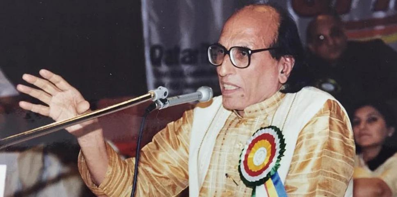
According to the commission’s report as obtained and reviewed by Nepal News, the list of individuals found to have occupied government or public land included figures from across Nepal’s political and bureaucratic establishment. Former Foreign Minister Bhesh Bahadur Thapa was named in connection with a land parcel identified as Parcel No. 8, Sheet No. 1106-13, covering 3 ropani, 13 aana and 2 paisa, of which 1 ropani, 11 aana and 1 paisa was found to overlap with public land.
Former Foreign Minister Ramesh Nath Pandey was found to have encroached upon a public roadway, occupying 4 aana, 3 paisa and 4 daam. Minendra Rijal, former Lieutenant General Ganesh Shamsher Rana and Kaman Singh Lama were also named in the report. The commission also concluded that Bhadra Ghale had illegally occupied public land, though structures on that particular plot have since been demolished.
The report further lists more than 5,000 additional individuals, including businesspeople, local figures and public officials. The document also reportedly implicates a former president, though detailed verification of that specific claim is ongoing.
Why did the report remain secret and unimplemented for 25 years?
The 1,350-page report was never officially made public after it was submitted in 1995. For over two decades, government agencies responded to inquiries about the commission by sharing only a brief summary stating that roughly 1,800 ropani had been found encroached upon.
The document implicated politicians, senior bureaucrats, military figures and business leaders, making any government willing to act on it vulnerable to significant political backlash. Successive administrations instead formed committees and working groups that produced little to nothing.
Did the Supreme Court ever intervene?
Yes, and decisively so. In 2003, advocate Prakash Mani Sharma filed a public interest litigation at the Supreme Court, arguing that the state had failed in its duty to protect public land. After years of proceedings, the court issued a directive order on May 26, 2010, instructing the government to give the Rawal Commission report high priority and move quickly toward its implementation.
The order also directed that encroachment on government land be investigated elsewhere in the country and that action be taken in accordance with existing law.
The court further directed the formation of a special committee comprising the Secretary of the Office of the Prime Minister and the Joint Attorney General, to report within three months on how the state could reclaim encroached public land.
That committee, too, failed to produce effective results. The 2010 Supreme Court directive remained largely unimplemented for the next 15 years, until the Cabinet decision of June 12, 2026 moved to act on it.
What other commissions and mechanisms have looked at this problem?
The Rawal Commission was not the only body to investigate public land encroachment in Nepal, though it remains the most detailed and consequential.
In 2019, the government formed another Commission on the Protection of Government, Public and Guthi Land, tasked with conducting district-level inventories of public land across the country. That commission also produced findings and recommendations, but implementation remained limited.
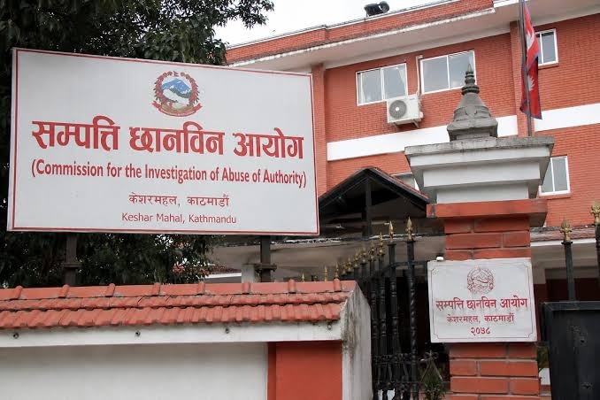
The Commission for the Investigation of Abuse of Authority has at various points written to the Ministry of Land Management seeking action on public land protection, including a letter in July 2013 that directed the ministry to formulate a future action plan incorporating feedback from previous task forces.
Individual local governments have also taken sporadic action. The then Kathmandu Mayor (now Prime Minister) Balen Shah launched a campaign to identify and reclaim encroached public land during his tenure, and by November 2025 the Kathmandu Metropolitan City had recovered an estimated 208 ropani of encroached land valued at approximately Rs 23 billion.
None of these efforts, however, addressed the Rawal Commission’s documented findings in a systematic way.
What has the government now actually decided, and what committee has been formed?
The Cabinet meeting of June 12, 2026 passed a directive to implement the 1995 Rawal Commission report in line with the Supreme Court’s 2010 order. It also directed that a systematic national record of government and public land be maintained and that protective measures be strengthened.
On the same day, the Ministry of Land Management, Cooperatives, Federal Affairs and General Administration constituted an eight-member facilitation committee. Krishna Prasad Sapkota, Deputy Director General of the Survey Department, was named coordinator.
The committee’s other members include the Under-Secretaries of the Home Ministry and the Ministry of Infrastructure Development, the heads of the Land Administration Office and the Survey Office at Dilli Bazaar, the chief of the Local Level Coordination Branch of the land management ministry, a section officer from the Department of Land Management and Archives, and a survey officer from the Survey Department serving as member-secretary.
Minister Pratibha Rawal said the committee would move to coordinate among all relevant agencies and complete its groundwork as quickly as possible.
What does the facilitation committee actually need to do?
The committee’s mandate centers on laying the administrative groundwork for actual enforcement of the commission’s recommendations. That means coordinating across multiple government agencies, including the Home Ministry, Survey Department, land administration offices and infrastructure-related bodies, all of which have overlapping responsibilities over land records and public assets.
The committee must reconcile survey data with the commission’s 31-year-old findings, identify which parcels remain encroached, determine the current status of land that has since changed hands or been subjected to court rulings, and recommend a process for recovery.
It also needs to assess how the commission’s ward-level encroachment data maps onto the current administrative structure of Kathmandu Metropolitan City, which has reorganized its ward boundaries multiple times since 1995. The committee’s work is a prerequisite for any enforcement action, legal proceedings or land reclamation that the government may subsequently pursue.
What are the main obstacles to actual implementation?
Even with a Cabinet directive, a facilitation committee and Supreme Court backing, several structural obstacles stand in the way of meaningful enforcement. Many of the parcels documented as encroached in 1995 have since changed hands multiple times, been subdivided, or had private ownership claims strengthened by subsequent land revenue records and even court decisions.
Unscrambling decades of transactions is legally and administratively complex. Several of the named encroachers are politically influential, raising questions about whether enforcement will be selective or comprehensive.
Land administration in Nepal is also fragmented across multiple agencies, meaning that even when political will exists, coordination failures can stall progress. The lack of a complete and verified national land inventory means that establishing the baseline for enforcement requires significant preparatory work.
And the commission’s data, which is based on cadastral records from 1964, must be reconciled with updated survey information, a task that requires considerable technical capacity.
Why is public land continuing to disappear in Nepal more broadly?
The Rawal Commission documented a crisis within one municipality, but the broader problem extends across the country. Nepal has consistently struggled to protect government, public and Guthi land for a combination of structural reasons. Survey laws that once required public land to be identified before private plots were measured were removed in 2000, significantly weakening protective mechanisms.
Land records across districts remain incomplete, contradictory or inaccessible, making it difficult even to establish what the state owns. In the Terai districts in particular, agricultural land, forest edges and riverbank areas have been extensively encroached upon by both landless families with few alternatives and by well-connected individuals who use forged documents or administrative connections to convert public parcels into private holdings.
Studies have found that where communities actively use and monitor public land, encroachment rates are significantly lower, suggesting that the absence of community stewardship is itself a factor.
What reforms do experts say are needed to protect public land long-term?
Analysts and former officials who have engaged with the Rawal Commission findings argue that enforcement alone is not sufficient to prevent future public land losses. Several reforms are consistently cited.
First, Nepal needs a complete, publicly accessible and regularly updated digital inventory of all government and public land, including maps, parcel numbers, and land area, maintained at the local government level.
Second, the overlapping and often contradictory legal framework governing land must be rationalized. Laws covering land administration, surveys, forests, local governments, roads and civil property rights currently create jurisdictional confusion that allows agencies to pass responsibility to one another.
Third, local governments and communities should be given a genuine role in monitoring and managing public land, including the authority to lease underutilized public land to economically vulnerable households under strict and transparent conditions.
Landholding ceilings must be enforced and land reform mechanisms used to address the underlying problem of landlessness without transferring public land to private ownership permanently.
What will determine whether this Cabinet decision produces real results?
The history of the Rawal Commission is essentially a history of announced intentions that went nowhere. Cabinet committees were formed in 1995 immediately after the report was submitted, yet none acted. A Supreme Court directive in 2010 changed nothing for 15 years.
What will distinguish the 2026 decision from those failures will depend on several concrete factors: whether the facilitation committee produces a time-bound action plan with clear milestones; whether enforcement action is taken against both politically connected and ordinary encroachers without discrimination; whether land reclaimed from encroachers is converted to documented public use rather than left vulnerable to re-encroachment; and whether the national land inventory the Cabinet also directed is actually built and made publicly accessible.
Minister Pratibha Rawal has framed the committee’s mandate as urgent, and the political context of the Balen Shah government, which has staked significant credibility on land governance, adds pressure to follow through.
Whether that pressure translates into durable administrative change will determine the Rawal Commission’s final chapter.