Kathmandu
Thursday, June 18, 2026


Studies from lakes like Rara and Tilicho are reshaping scientific understanding of western Nepal’s seismic history and long-term earthquake risks
KATHMANDU: For geologist Ananta Gajurel, lakes and ponds are not just places for travel and sources of water, but also places for study. Having spent four decades as an Associate Professor of geology, Gajurel retired from Tri-Chandra College last week. During this period, he conducted studies and research on various lakes in collaboration with domestic and foreign teams.
Gajurel has been involved in research conducted in Nepal by international organizations such as National Geographic and British and French researchers, using lakes as a foundation. He says that lakes carry the history of many subjects, including climate, geology, biodiversity, and human activities. “A lake has its own ecological system (ecosystem). That system is determined by many things like temperature, rainfall, and water level. The sediment accumulated at the bottom of the lake acts like an archive,” he says.
For a long time, we viewed Nepal’s lakes only from religious, cultural, or tourism perspectives. However, for scientists, these lakes contain a history collected over a long flow of time, where information ranging from climate change to earthquakes is preserved. The latest study conducted at Rara Lake has challenged the prevailing belief regarding the ‘seismic gap’ in Western Nepal and has started a new debate about seismic risk.
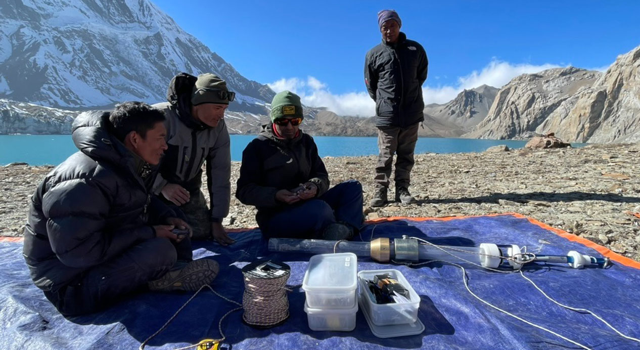
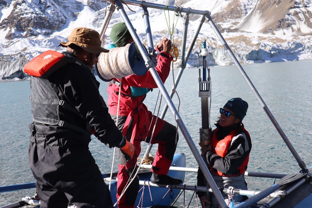
Geologists conducting research at Tilicho Lake
Gajurel has studied major lakes located in the high Himalayan and mid-hill regions of Nepal. These include Phewa in Pokhara, Rara in Mugu, Shey-Phoksundo in Dolpa, Dhumba and Tilicho in Manang, and Gokyo Lake in the Everest region. The study at Rara Lake was conducted under the leadership of Zakaria Ghazoui-Schaus from the British Antarctic Survey. The study challenged the notion regarding the ‘seismic gap’ of Western Nepal.
The British Antarctic Survey team began the study in 2014, and the research article was published in the Advanced Science journal in January 2026.
It has been a long time since a major earthquake occurred in Western Nepal. From a seismic perspective, Western Nepal is not as active as the eastern part of Nepal. Although a history of major earthquakes occurring at intervals of 80 to 100 years is found in the eastern region, it has been more than 500 years since a mega-earthquake occurred in Western Nepal. There was no information of a major earthquake occurring after the mega-earthquake of 1525. Scientists used to say that because the ‘seismic gap’ in Western Nepal was very long, energy had accumulated for a mega-earthquake to occur.
The study conducted by Schaus’ team at Rara Lake since 2014 showed that at least five major earthquakes have occurred in Western Nepal since 1525. In the study, it was found that while 50 major earthquakes occurred in that area in 6,000 years, five have occurred since 1525 alone. The study also showed that there is no specific pattern of earthquakes occurring in that region.
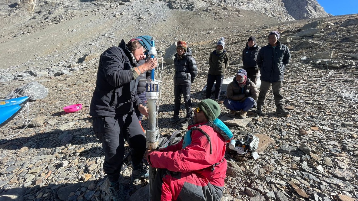
Geologists at Tilicho Lake
Nepal is situated on the boundary of the Eurasian and Indian tectonic plates. This region falls under high seismic risk.
Studies regarding lakes
Study and research on various subjects are being conducted in Nepal using lakes as a foundation. Tanka Prasad Paudel, Assistant Campus Chief of the Nepal Mountain Academy, who is involved in lake-related studies, says that research is conducted both on subjects related to the lake and subjects within the lake. “One is, research is done on how the lake was formed, what its size and history are,” he says. “The other is, subjects are studied by treating the lake as ‘prime data,’ meaning primary data for research.”
Geologists are researching the history of earthquakes, climate change, and geographical origins using lakes as a foundation. Geologist Gajurel is involved in studies in the Everest region in collaboration with National Geographic. Multi-dimensional subjects such as biodiversity, glacial lakes, climate, and cartography have been studied in that region. Especially, research has been conducted on the effects of climate and earthquakes over the past two thousand years by extracting a ‘sediment core’ (sludge of soil and sand) from here.
At Rara Lake, primarily records of old earthquakes are being studied. Through the study of sediment, it has been found that a history at least 6,500 years old is preserved in this lake. This time refers to the period when humans moved from a nomadic state to settling in one place and starting agricultural work.
Gajurel says that while our equipment (seismometer—earthquake measuring device) and historical records for studying earthquakes are limited to a short period, the study of lakes helps analyze history from much further back. “Thousands of years of history are preserved at the bottom of the lake. If the pattern of which times major earthquakes occurred and at what intervals they occur is discovered, then future risks can be known,” he says.
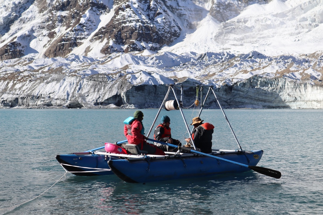
Geologists conducting research at Tilicho Lake
Meanwhile, at Tilicho Lake in Manang, a study is being conducted in collaboration with the British Antarctic Survey. Since this lake is formed entirely from a glacier, work is being done to determine its structure and how many years old the ‘moraine’ (debris accumulated by the glacier) is.
The British Antarctic Survey is also conducting a study at Phewa Lake in the tourist city of Pokhara. In this, research is being conducted on the origin of the lake, the impact of earthquakes on the lake bed, and the effect of human activities on the environment. “Due to activities like human encroachment, house construction, and dams, Phewa Lake is not considered very suitable for study from a scientific perspective,” Gajurel says. “The age of Phewa Lake is also only about 500 years, and because there has been a lot of human intervention in it, it is difficult for scientists to find pure natural records.”
The issue of Phewa Lake encroachment has always been a topic of discussion. In the list of one hundred tasks to be completed in one hundred days made public after the formation of the new government in late March, 2026, the removal of encroachment on Phewa Lake is also mentioned.
French and Belgian teams have conducted studies at Shey-Phoksundo Lake. Research has been done on its formation process (formed by a landslide blocking a river) and its age. Based on soil studies, Japanese researchers have estimated that this lake could be about 30 to 35 thousand years old.
Paudel, Assistant Campus Chief of the Nepal Mountain Academy, says that since different types of data are stored within lakes since history, research can be conducted on different subjects according to time and purpose. He is involved in the study of Gosaikunda in Rasuwa, Panchpokhari in Sindhupalchok, and Tilicho Lake in Manang. “This year, however, work could not be done properly due to a lack of money and time,” he says.
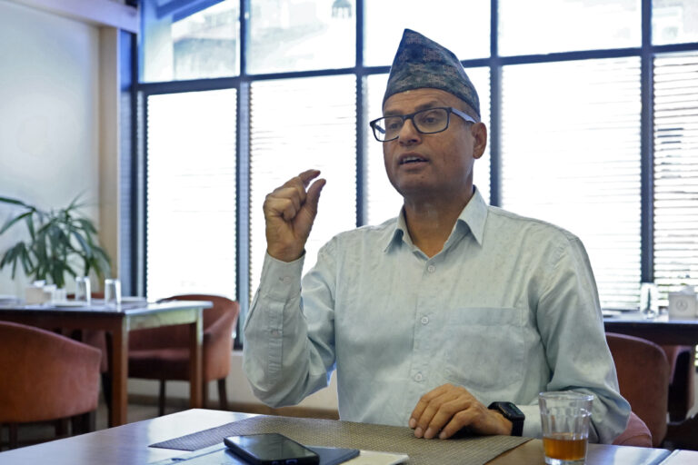
Ananta Gajurel. Photo: Bikram Rai/Nepal News
In a study conducted in 2009, lakes were found in 74 out of the 75 districts at that time. According to the research article titled ‘A Map Based Inventory of Lakes in Nepal’ published in Volume 11 (2010) of the Nepal Journal of Science and Technology, there are 5,358 lakes in Nepal. Ukesh Raj Bhuju, Madhukar Khadka, Pawan Kumar Neupane, and Radium Acharya conducted that study.
How does a lake tell history?
To understand history, we often depend on paper documents, inscriptions, or oral stories. However, researchers are also uncovering various aspects of history by studying geological and environmental layers accumulated at the bottom of lakes.
Layers are formed in stages at the bottom of a lake. Such layers are formed according to the cycle of the seasons. For example—it rains heavily during the summer or rainy season; floods wash away soil, sand, and small particles into the lake. As this settles, a brown and white colored layer is formed at the bottom of the lake. Another layer is formed in winter, but it is of a different type. Lakes in high altitude regions freeze in winter, due to which the impact of external activities does not reach the lake. Soil, sand, and other objects cannot come from outside. However, the process of animals, plants, and organic matter inside the lake decaying and slowly falling to the bottom continues. Such organic materials have a high carbon content. Therefore, this layer is dark brown or black. Layers formed in this way are analyzed during the study. “These layers show records of what the temperature and rainfall were like. The sediment at the bottom of the lake is very important for looking at past climate changes or tectonic—meaning earthquake—events,” says Gajurel.
When a major earthquake occurs, the bottom of the lake and the water shake along with the ground. Landslides occur around the lake, and objects in them also fall or get swept into the lake. Large stones or debris that water cannot wash away under normal circumstances reach the lake during an earthquake. This leads to the formation of a different kind of structure inside the lake. Sediment sits in layers at the bottom of the lake. When shaken violently by an earthquake, the form of those layers gets distorted or moved up and down. “By looking at this sign, we can estimate what magnitude of earthquake might have occurred in the past,” Gajurel says.
Similarly, there is a study of pollen regarding the subject of weather. From the study of pollen blown by the wind into the lake, it is known what types of grass or trees were present at what time and what the temperature was like. Likewise, by analyzing the remains of aquatic animals like snails and microorganisms, research is done on what the temperature was like in the lake and its surrounding areas during which time period.