Kathmandu
Monday, June 15, 2026


The solution to the Nepal-India border dispute must be found through the political willpower, technical studies, and active diplomacy of both nations, rather than via a third party.

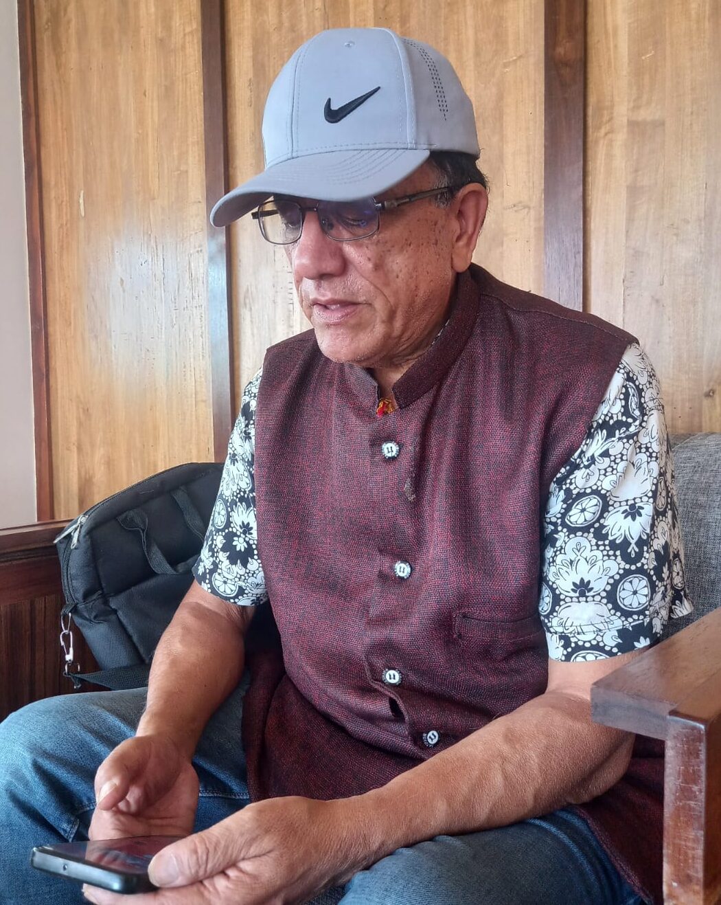
Prabhakar Sharma is an international border expert and geodetic engineer. He served as a United Nations consultant from 2007 to 2019 during the international boundary demarcation between Nigeria and Cameroon. An edited excerpt of the conversation between Sharma and Mani Dahal for Nepal News regarding the Nepal-India border dispute, border management, and measures adopted by various nations to resolve border conflicts follows:
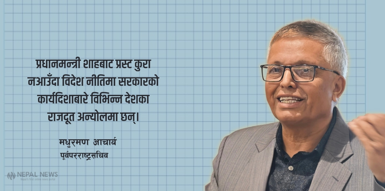
Prime Minister Balendra Shah’s statement regarding the border courted controversy. However, this issue appears to have reached both the government and public levels in Nepal and India. Has an opportunity to resolve the border dispute with India arrived?
If we want to find a solution by discussing the border dispute with India, we must first create an environment conducive to it. Steps must be taken by both sides to build an atmosphere of trust. For that, willpower is required within the political leadership of both nations. At present, there are powerful governments on both sides, and it appears that such a desire exists within both political leaderships.
Rastriya Swatantra Party (RSP) Chairman Rabi Lamichhane visited Delhi, which was followed immediately by the Foreign Minister’s visit. Discussions between the two sides covered not only economic matters but also the border issue. It is positive that Foreign Minister Khanal raised the Kalapani issue during a press conference in Delhi.
An interview with Ranjit Rae, the former Ambassador of India to Nepal, has been published. In it, he stated that the Kalapani and Susta issues should be resolved at the political level. There is a technical aspect to this, not just a political one. The Susta issue must be looked at from a technical standpoint as well. On the Kalapani issue too, a positive outcome can be achieved through political-level talks backed by respective documents and evidence.
Both sides must find where the meeting point lies. The nine articles of the Sugauli Treaty, which came into effect on March 4, 1816, had already determined the boundaries of Nepal from where to where. It was written there that the King of Nepal and his descendants would not claim the territory west of the Kali River.
Meanwhile, the matter spoken by Prime Minister Shah in Parliament has become controversial. Ordinary citizens of both countries are talking about this. At such a time, it is necessary to look at some international examples. We were deployed on the field on behalf of the United Nations for the boundary demarcation between Nigeria and Cameroon. Even at that time, the boundary demarcation issue between those two countries was publicized in a way that ordinary people could understand. Now, it is necessary to make the people of Nepal and India understand the border issue thoroughly as well.

The Sugauli Treaty remains the primary basis for resolving the Nepal-India border dispute. The supplementary treaties signed after that must also be brought out and examined.
But hasn’t ‘cartographic aggression’ on the western border been occurring since the British era following the treaty?
When the Sugauli Treaty took place, Hastings was the Governor-General of the East India Company. After the Sugauli Treaty, Chautaria Bam Shah moved from being the Commissioner of Kumaon to the Governor of Doti. Hastings wrote that after Nepal lost the war, a path must be cleared for Bam Shah and his soldiers to cross the Kali River from Kumaon toward Nepal without any hindrance.
The British had also written that the Kali is a large river. Nepalis also understood that the Kali refers to the river originating from Limpiyadhura and flowing downstream through Nabhi, Kuti, and Gunji. Later, after the Kali River originating from Limpiyadhura goes downstream via Kuti, Gunji, Nabhi, and Garbyang, it becomes known by the name of the Sharda River.
Bam Shah had also claimed at that time that the villages of Kuti, Gunji, and Nabhi in the Vyas Praganna, as well as Changru and Tinkar, must belong to Nepal. On February 4, 1817, J. Adam, the Acting Chief Secretary of the East India Company, corresponded with Edward Gardner, the Residential Representative in Kathmandu, stating that these villages should be left to Nepal based on the Sugauli Treaty.
However, contrary to the Sugauli Treaty, the same Chief Secretary suddenly issued another correspondence on September 5, 1817, to G.W. Traill, the Commissioner of Kumaon, stating that the two villages of Kuti and Nabhi in Vyas Praganna must be placed under British India in accordance with the orders of Hastings. Following Bam Shah, continuous claims do not seem to have been made from Nepal’s side on this matter.
The British communication, documentation, and map management were stronger than ours. Have matters related to Nepal been sufficiently studied in their internal communication, documents, and maps?
Further study of the documents available with Britain is still necessary. They can clarify many things. Currently, many materials have also been digitized. Speaking personally, if done through government channels, the response will be better, and the resolution of the border dispute can be achieved faster. It is also necessary to clarify what the intentions of the British were at that time.
During the era of the East India Company and British India, the Survey of India was the only institution that issued maps. The Survey of India named five other rivers as the Kali. That naming kept shifting further east. In 1879, it appears that the river originating from Lipulekh was named the Kali.
Currently, the Indian military camp located in Kalapani is situated even further east than the place shown in the map issued by the Survey of India. The territory from Limpiyadhura to Lipulekh is visible in maps from the British era itself.
What is revealed when looking at the structure of the river and hydrology?
The British talked about the ‘main stream’ and ‘main branch’. They called the river coming from Lipulekh the main branch and the one coming from Limpiyadhura the main stream. The main stream of the Kali River refers to the Kali originating from Limpiyadhura.
Nepal had ruled Kumaon and Garhwal for about 25 to 30 years. British India’s claim that the western river boundary accepted by Nepal should be a narrow Kali seems strange. According to international rules, a river that can be easily crossed back and forth is not considered ideal for boundary demarcation.
The main river within a river system is determined by looking at the length, number of tributaries, size of the catchment area, and water volume. In English, a river is also called large or small based on ‘water volume’. On this basis, the large Kali is indeed the river originating from Limpiyadhura.
The Kali River appears to have been named from Kali one, two, up to five. In the map issued in 1879, the river originating from Limpiyadhura was named Kuti Yangti. The map issued in 1929 also used that as a basis. When Nepal issued maps in 1975 and 1985, it appears to have excluded Kuti, Nabhi, Gunji, and Limpiyadhura from its map. However, it appears to have included the Kalapani area and Lipulekh in its map.
British India and present-day independent India have called the map concerning Lipulekh issued in 1879 a scientific map. That is a map issued after a trigonometric survey; therefore, it can be accurate. What needs to be understood is that the name and boundary of a river do not change without a treaty between the two countries.
Apart from Kalapani and Susta, Nepal and India have completed boundary demarcation across 97 percent of the territory. What is the condition of the places where demarcation has been completed? How is our border management? Has proper work been done on this?
News reports stating that problems still exist continue to emerge. Talk of removing encroachments in the ‘No Man’s Land’, i.e., the Dasgaja, has come up. In the Dasgaja, 30 feet have been left on both sides of the border. In several places, drains have even been constructed and maintained. Such work used to be done by the British.
Nepal had once proposed to the British that we would clean the drains on our side ourselves. However, the British cleaned them themselves, stating that it fell under their responsibility.
Even now, residents from both sides are living in some places within the Dasgaja area. I do not call this border encroachment, but this territory must be left open.
According to international norms, main pillars should be placed every five kilometers and minor pillars every 500 meters on international borders. Have Nepal’s demarcations been carried out accordingly?
Although that is the international standard, Nepal’s pillar arrangement is slightly different. This depends on the location. The main pillar placed at five kilometers sits two meters underground and two meters above ground. The pillar placed at 500 meters is half a meter underground and half a meter above ground.
Pillars must also be placed at points where directions change. Although it is said to be placed every five kilometers, pillars must be installed at turnings, watersheds, or where a path intersects the international border. It does not feel like that has been done in Nepal.
When boundaries need to be separated in settlement areas, pillars are placed even at every 100 meters. This is because the land must be divided there. Since we share an open border with India, the ‘densification’ of pillars should be lower, meaning they should be placed closer together. Even to eliminate the Dasgaja problem, border pillars must be placed close to one another. If the issue is very complex, they should be placed not just every 100 meters, but even every 50 meters.
An arrangement for free movement exists between Nepal and India. There is an open border. Has this complicated the problem?
Because of the open border between Nepal and India, movement and farming in the border areas are smooth. Due to this, the practice of Nepalis farming on the Indian side and Indians farming on the Nepalese side is visible in some places. However, just because someone farms on the territory of another country, that territory does not become part of their country. Therefore, it is appropriate to call this situation ‘cross-border farming practice’ or ‘cross-border holding’ rather than ‘cross-border occupation’.
If the Dasgaja area is being utilized, trenches can be dug on both sides. There are various ways to manage the border; appropriate methods can be applied.
Problems exist even in some places where demarcation has been completed. Whose job is it to provide information regarding that?
Problems exist in many places. It is better to obtain the facts regarding that from the Department of Survey. It might have occurred from Nepal’s side too, but looking at the population scenario, it is likely higher from India’s side. This, however, is not a major issue. During maintenance periods, Nepal’s Armed Police Force and India’s Border Security Force open it up through mutual cooperation.
The agency responsible for stating how many places have holdings in the Dasgaja is the Department of Survey. For this, surveys must take place intermittently. Wherever a problem is spotted, a mobile team must go there immediately. The Department of Survey must send a team regularly, at least once a year.
An individual cannot speak on the issue of the border. The nation itself must speak on this matter. The Department of Survey can publish a booklet, even if it is for internal purposes. The government must possess such a document. At the very least, the Ministry of Home Affairs, which is tasked with border management, must possess specific details indicating that encroachment has occurred in these exact locations. Currently, official records regarding the status in various locations are not found.
While speaking in Parliament, Prime Minister Balendra Shah mentioned that he had requested assistance from Britain for documents. That was interpreted as third-party mediation. When ruling India, British documentation was more organized than ours. Could documents that can play a role in resolving the Nepal-India border dispute be there?
Certainly, documents of this nature ought to be with Britain. In Britain, such materials can be found in two places: the India Office Records of the British Library and the Royal Geographical Society, London.
One does not have to pay money at the British Library. It is accessible to come and go, but time must be dedicated to study. They have digitized historical documents and kept them. Things not present at the British Library could be at the Royal Geographical Society. Access is smooth in both places, but time is required for study.
It is better if individuals knowledgeable about the border go with letters of recommendation from the government level. It must be examined which maps or historical documents are available. Nepal ‘War Papers’ exist separately. Correspondences that took place between British officials of that time, as well as between Nepal and Britain, are also available. Documents up to the time the British remained in India, i.e., up to 1947, could be there. A serious study of them could reveal something or the other.
Whether a map was issued along with the Sugauli Treaty is an important matter. Captain Webb had created a sketch map in 1819. In it, the Kali River appears originating from Limpiyadhura. It is shown that the source is right there.
Some argue that this merely showed the Kali River and was not a demarcation. Sam Cohen has also written about this. He mentioned that although Captain Webb showed it that way initially, he altered it later. However, what is stated in his book is not clear.
Based on the waterfall originating from Tureture in Kalapani, it has been claimed that ‘this is the boundary, and Kalapani originates from here.’ According to international standards, a narrow seasonal stream or a small branch of a river, i.e., a ‘fordable river,’ is not considered a boundary. However, coming down to 1879, they showed Nepal’s boundary along the river originating from Lipulekh. For that, the map has been changed 6–7 times.
Not just Nepal and India, but South Asia itself is a massive region of border disputes. Demarcation has not been achieved between India and China in the Himalayan region either. A similar problem exists between India-Pakistan and Pakistan-Afghanistan. What is the impact caused by border disputes?
The greatest impact is that it has increased mistrust between nations. Wars have been fought in this region. Such border disputes exist even between nuclear-armed nations. Border disputes keep creating a state of war perpetually.
A clash took place between Indian and Chinese soldiers in Galwan. A standoff situation was also created with Indian soldiers in Doklam, the border area of Bhutan and China. In such situations, large countries try to exert pressure on smaller countries.
When British rule existed in India, they tried to extend up to Tibet. The British from the south and Russia from the north sought to expand their influence. China took Tibet. The very characteristic of an empire is the expansion of territory and influence. Bhutan and Sikkim were all under British influence.
Another thing that must not be forgotten is that many border problems in the world are linked to British colonization. They carried out around 40 percent of the world’s border demarcations. They demarcated borders in a manner convenient for running their empire. They stayed as long as they could, and when they couldn’t, they left. That demarcation continues to cause problems even today.
The British Empire, by capturing various countries, engaged in joining and dividing territories to create structures favorable to itself. Are the border problems being faced today created by them?
Dismantling is one thing. They also separated countries. Previously, almost all borders were No Man’s Land. No Man’s Land means not just the Dasgaja, but empty fields or vacant land as well. In such places, the powerful try to establish their dominance. They try to snatch it from whoever is weak.

With China, our border is the Himalayas itself. China took Tibet in 1951. It signed an agreement with us in 1961. Because, on the other side was Tibet. China shares borders with 14 nations, including Nepal and Burma. The two countries with which its border disputes remain unresolved are India and Bhutan.
Is the resolution of the border dispute halted due to a lack of political willpower or because of domestic political reasons?
Former Indian Ambassador Ranjit Rae, in a recent television interview, stated that Prime Minister Balendra Shah is currently entangled in internal matters. In that interview, Rae compared Shah to a blank slate, saying that a new chapter should now be written. His point is to create a favorable environment for consensus on issues including the border.
India stands to benefit by moving forward maintaining cordial relations with Nepal. Maximum effort must be made for that.
Nepal going to the international court or seeking third-party mediation will not work. A solution must be sought through bilateral talks with India itself. Now, Nepal and India must move negotiations forward by setting a deadline. Active diplomacy must be pursued from both sides to resolve the problem.
The border problem that existed between India and Bangladesh for 40 years was resolved on land in 2015 when Narendra Modi and Sheikh Hasina were Prime Ministers. Because their ‘wavelength’ matched. The maritime boundary, however, was resolved by them by going to the international court.
Almost all border demarcation between Nigeria and Cameroon has also been completed by now. They had started that process in 2007. If Bangladesh and India, as well as Nigeria and Cameroon, can resolve border disputes, why can’t Nepal?