Kathmandu
Wednesday, June 24, 2026


India’s 2026 Kailash Mansarovar Yatra plan via Lipulekh revives a long-standing territorial dispute, with Nepal citing the 1816 Sugauli Treaty, historical maps, and constitutional claims to defend its sovereignty over the contested Himalayan tri-junction

KATHMANDU: On April 30, 2026, India announced plans to resume the Kailash Mansarovar Yatra via Lipulekh Pass, just months after India and China had already agreed in August 2025 to reopen Lipulekh for bilateral trade without any consultation with Nepal.
On May 3, Nepal’s Ministry of Foreign Affairs immediately issued diplomatic notes to both countries, reaffirming that Limpiyadhura, Lipulekh, and Kalapani are integral parts of Nepal under the 1816 Sugauli Treaty. India’s Ministry of External Affairs swiftly rejected Nepal’s claim as “untenable,” insisting the route has been in use since 1954. The standoff has reignited one of South Asia’s most persistent territorial disputes.
This Nepal News explainer examines the historical roots, legal arguments, and geopolitical stakes behind the Limpiyadhura–Kalapani–Lipulekh dispute, and why the issue continues to resurface between Nepal, India and China.
What exactly is the Limpiyadhura–Kalapani–Lipulekh dispute, and why does it matter to Nepal?
The Limpiyadhura-Kalapani-Lipulekh dispute is one of the most consequential unresolved territorial questions in South Asia: a conflict over approximately 372 square kilometres of high-altitude Himalayan territory at Nepal’s far northwestern corner, in what Nepal considers its Darchula district of Sudurpashchim Province. The area forms the apex of a strategic tri-junction where Nepal, India and China converge.
For Nepal, this is not merely a boundary technicality. It is a matter of constitutional sovereignty, national identity, and the legal integrity of a 210-year-old treaty. Nepal’s position, backed by historical maps, river science, and the 1816 Treaty of Sugauli, is that Limpiyadhura, Lipulekh, and Kalapani lie to the east of the Mahakali (Kali) River, which the treaty defined as Nepal’s western boundary. The territory has been under Indian military administration since 1962, but Nepal has never recognised that occupation as legitimate.
The dispute matters deeply because India has used the area to build roads, station troops, conduct trade with China, and now organize religious pilgrimages: all on what Nepal maintains is Nepali soil. The failure to resolve this dispute undermines Nepal’s territorial integrity and sets a dangerous precedent for how larger neighbours may treat smaller states in the region.
What was the Treaty of Sugauli (1816), and how does it form the legal foundation of Nepal’s claim?
The Treaty of Sugauli, signed on 2 December 1815 and ratified on 4 March 1816, was a peace agreement that ended the Anglo-Nepal War (1814–1816) between the Kingdom of Nepal and the British East India Company. Signed by Nepal’s Raj Guru Gajaraj Mishra and Chandra Shekhar Upadhyaya on behalf of King Girvan Yuddha Bikram Shah, and by Lieutenant Colonel Paris Bradshaw for the Company, the treaty drastically reduced Nepal’s territory (from approximately 267,000 sq. km to around 147,000 sq. km), requiring Nepal to cede Garhwal, Kumaon, Sikkim, and large Terai stretches.
The treaty’s Article V is the legal cornerstone of the current dispute. It states that the Rajah (King) of Nepal “renounces for himself, his heirs, and successors, all claim to or connextion with the countries lying to the west of the River Kali.” This means everything east of the Kali River, including the Kalapani valley and Lipulekh Pass, belongs to Nepal. The critical unresolved question is: where exactly does the Kali River originate?
Nepal argues it begins at Limpiyadhura, the most western source, which means all territory east of that point, covering approximately 372 sq. km including Kalapani and Lipulekh, is Nepali. India argues the river begins further east near Kalapani village, effectively shrinking Nepal’s claim. This ambiguity in the treaty text is the root of the entire modern dispute.
Some western Terai land was later returned to Nepal in 1860 as a reward for Jang Bahadur Rana’s assistance to the British during the Indian Rebellion of 1857. The Sugauli Treaty remains the foundational legal document governing Nepal’s western boundary to this day.
What is Nepal’s specific argument about the source of the Kali River, and what historical evidence supports it?
Nepal’s position rests on a robust body of historical cartographic and documentary evidence. Buddhi Narayan Shrestha, former Director General of Nepal’s Land Survey Department and one of the foremost experts on this issue, has argued that the river flowing to the west of Kalapani is the main Kali River, and that it originates at Limpiyadhura (at approximately 30.4°N, 80.57°E).
This claim is supported by a series of maps prepared by the Survey of British India in 1819, 1827, 1834, 1835, 1837, 1846, 1850, 1856, 1860, and 1879. An analysis of these maps, particularly those from before 1857, consistently shows the Kali River’s source traced to Limpiyadhura, flowing east through Parbati Kunda, Kuti Village, Navi Village, and Gunji Village before joining the Tinkar Khola at Chhangru Village. The 1819 map drawn by W.J. Webb, and the SDUK map of 1834, both show the Kali River’s source in the Byas Valley which corresponds to Limpiyadhura.
Furthermore, the “Old Atlas of China” published during the Qing Dynasty in 1903 uses Chinese characters to label Limpiyadhura as the source of the Kali River, with the word “Nepal” inscribed for the northeastern portion of the river basin. Nepal also draws on the Nepal–China Boundary Treaty of 1961, which places the tri-junction between Nepal, China, and India at the western extremity of Nepal at a point consistent with Limpiyadhura being Nepal’s boundary.
Scholars note that British India’s maps shifted the Kali River’s source progressively eastward after 1857, from Limpiyadhura to Lipu Gad and then to the Pankha Gad stream near Kalapani by 1879, a cartographic manipulation that favoured India’s later claims.
What is India’s counter-argument, and how does it justify its presence in Kalapani?
India’s position has several layers. First, on the source of the Kali River, India argues that the river originates near Kalapani village, specifically from a stream known as Lipukhola or Kalapani Gad, and not from Limpiyadhura. India contends that a small rivulet known as Pankhagad to the south of Kalapani, combined with the ridgeline on the east side, forms the true border, placing the Kalapani area within Indian territory.
Second, India presents administrative and revenue records dating back to the 1830s, available with Uttarakhand state, to argue that Kalapani has historically been administered as part of Pithoragarh district in Kumaon. India says a state police post was established at Kalapani in 1956 and has operated continuously since. Since 1979, the Indo-Tibetan Border Police (ITBP) has maintained a permanent post there.
India also argues that the boundary alignment accepted by Nepal in the Nepal–China Boundary Treaty of 1961 and the Nepal–China Boundary Protocol of 1963 placed the tri-junction consistent with India’s interpretation, not Nepal’s.
Kailash Mansarovar
Third, India insists the Lipulekh Pass has been used for trade and the Kailash Mansarovar pilgrimage since 1954, and that such longstanding usage is itself evidence of Indian administration. India has also constructed a Kali temple at Kalapani, which Nepali observers view, as a deliberate political act to reinforce its territorial claim.
India consistently calls Nepal’s updated maps an “artificial enlargement” of territorial claims and maintains they are not based on historical facts or evidence.
How and when did India militarily enter Kalapani, and why did Nepal not immediately contest it?
The critical turning point came in 1962, during the Sino-Indian War. As fighting broke out between India and China, the Indian Army deployed troops to the Kalapani area, a strategic high-altitude position, that allowed India to monitor Chinese military movements across the Lipulekh Pass and the Tibetan plateau beyond.
Nepal’s then-King Mahendra was aware of the Indian deployment. According to former Nepali Foreign Minister Bhekh Bahadur Thapa’s account in his book Rashtra–Pararashtra, King Mahendra explicitly stated: “Right now India and China are at war. If we raise this issue now, it will look like we are taking sides. We should raise it after the war and seek a solution.” This decision to stay silent, made to avoid the appearance of siding with China during the Sino-Indian conflict, had profound long-term consequences.
After the war ended, India withdrew from most northern border posts it had temporarily occupied but crucially retained its position at Kalapani. There are also reports that in the early 1960s, King Mahendra gave tacit consent to Indian Prime Minister Jawaharlal Nehru to continue using the Lipulekh–Kalapani area.
What was intended as a temporary wartime arrangement hardened into a permanent occupation. By 1979, the ITBP had formally taken over the Kalapani post, and India had effectively consolidated its administrative grip on the area. Nepal’s silence had, in retrospect, created a dangerous ambiguity that India would later exploit.
What was the role of the 1991 reopening of Lipulekh, and when did Nepal first formally raise the border issue?
The year 1991 was a watershed moment. After Nepal transitioned from the Panchayat system to multiparty democracy in 1990, political space opened for a more assertive national discourse. That same year, India and China agreed to reopen the Lipulekh Pass for bilateral border trade: a decision made entirely without consulting Nepal.
Nepali Byasi traders from the Tinkar valley, who had been using the Tinkar Pass for trade with Tibet after Lipulekh was closed in 1962, found themselves excluded. Indian Byasis were allowed to use the newly reopened Lipulekh Pass, but Nepali citizens were effectively denied access.
Nepal’s formal protests began to take shape through the mid-1990s. A Joint Technical Level Nepal–India Boundary Committee (JTC), composed of the Surveyor Generals of both sides, had been meeting since 1981 primarily to re-identify and replace damaged boundary pillars along the border. The committee succeeded in delineating approximately 98 percent of the Nepal–India boundary but left Kalapani and the Susta region explicitly unresolved. The Kalapani issue was formally raised as a live diplomatic concern only in 1996, during parliamentary debates over the Mahakali Treaty.
The Greater Nepal movement, led by intellectuals like Buddhi Narayan Shrestha, also emerged in 1991, demanding return of all territory lost to the British East India Company since 1819. This movement gave scholarly backing to Nepal’s territorial arguments and helped internationalise the claim for Limpiyadhura as the true source of the Kali River.
What is the Mahakali Treaty of 1996, and how did it bring the Kalapani issue to the forefront?
The Mahakali Treaty, formally the Treaty between His Majesty’s Government of Nepal and the Government of India Concerning the Integrated Development of the Mahakali River, was signed on 12 February 1996 by then-Nepali Prime Minister Sher Bahadur Deuba and his Indian counterpart P.V. Narasimha Rao in New Delhi. It was ratified by Nepal’s Parliament with a two-thirds majority on 20 September 1996, as required by Article 126 of the Constitution of Nepal.
The treaty covered integrated development of the Mahakali River, including the Sarada Barrage, Tanakpur Barrage, and the proposed Pancheshwar Multipurpose Project.
The treaty was significant because it formally recognised the Mahakali River as a boundary river between the two countries. This recognition implicitly brought the question of the river’s origin, and thus the Kalapani boundary, into sharper diplomatic focus. When the treaty came up for parliamentary debate, opposition Communist Party leaders raised 27 objections, one of which specifically pointed to the existence of Indian military forces at Kalapani as evidence of Indian encroachment on Nepali soil.
The Mahakali Treaty has itself remained largely unimplemented more than two decades after its signing. The Pancheshwar Multipurpose Project has never been completed.
Critics in Nepal argue that India negotiated the treaty to consolidate its position on the Mahakali River boundary while simultaneously avoiding any resolution of the Kalapani issue. The treaty’s deadlock has further strained Nepal–India relations and stands as an example of the asymmetric power dynamic in bilateral water negotiations.
What happened in 2015 when India and China agreed to use Lipulekh for trade and how did Nepal respond?
On May 15, 2015, during Indian Prime Minister Narendra Modi’s visit to China, India and China signed a joint statement, specifically Point 28 of a 41-point declaration, agreeing to use the Lipulekh Pass as a trade entrepôt between the two countries. This agreement was reached entirely without Nepal’s knowledge, consent, or even notification. Nepal was blindsided by the announcement.
The then government of Prime Minister Sushil Koirala sent formal diplomatic objections to both India and China, marking the first time Nepal took such a strong and explicit public stand — declaring Limpiyadhura, Kalapani, and Lipulekh as Nepali territory. International relations experts described this as the moment when the Lipulekh encroachment was truly “internationalised,” forcing both India and China to acknowledge Nepal’s official protest on record. Nepal’s Parliament also debated the India–China trade agreement and condemned it as a violation of Nepal’s sovereign rights over the territory.
India responded that trade through Lipulekh had been occurring since 1954 and was not a new development. China offered no substantive support to Nepal’s position. Despite Nepal’s formal objections, both India and China proceeded with their bilateral arrangements, treating the Lipulekh Pass as though it were entirely within Indian territory.
The episode demonstrated the difficult geopolitical position Nepal occupies: sandwiched between two nuclear-armed neighbours whose shared strategic interests can override Nepal’s sovereign concerns.
What triggered the major 2019–2020 escalation, and what did Nepal do in response?
The crisis escalated in two stages. First, on November 2, 2019, India published a new political map following its reorganisation of Jammu and Kashmir into two Union Territories. This updated map clearly showed Kalapani, Lipulekh, and Limpiyadhura as part of India’s Pithoragarh district in Uttarakhand.
Nepal protested immediately and on November 20, 2019 issued a formal diplomatic note to India, attaching historical records and treaties to establish that Limpiyadhura is the actual origin of the Kali River and that these territories belong to Nepal.
The second and more explosive trigger came on May 8, 2020, when India’s Defence Minister Rajnath Singh inaugurated a 75-kilometre road linking Dharchula in Uttarakhand to the Lipulekh Pass on the Indo-China border.
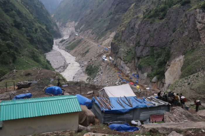
Road construction site in Lipulekh. Photo courtesy: RSS
For Nepal, this was a direct physical provocation: a road built through territory Nepal claims as its own, opened with a grand ceremony without any consultation. The then Oli government responded swiftly. On May 20, 2020, the Cabinet released a new official political and administrative map of Nepal that incorporated Limpiyadhura, Lipulekh, and Kalapani, adding approximately 335 square kilometres to Nepal’s claimed territory.
What followed was extraordinary. The constitution amendment bill to enshrine the new map in Nepal’s national emblem was presented to Parliament. On June 13, 2020, all 258 members of the House of Representatives present voted unanimously in favour — zero opposing votes. On June 18, 2020, the National Assembly (upper house) also passed the bill unanimously, and the then President Bidya Devi Bhandari authenticated it the same day. India called Nepal’s new map an “unjustified cartographic assertion” that would “not be accepted.”
What is the strategic and geopolitical importance of Lipulekh Pass, and why does India insist on retaining control?
Lipulekh Pass, at an elevation of approximately 5,080 metres on the Nepal–China border, is one of the most strategically important high-altitude passes in the entire Himalayan arc. Its geopolitical significance is multi-dimensional and touches on military, economic, and religious considerations.
From India’s perspective, Kalapani and Lipulekh serve as a forward surveillance and military monitoring position directly overlooking the Tibetan plateau and the People’s Liberation Army’s western strategic zone.
India has stationed the Indo-Tibetan Border Police at Kalapani year-round since 1962 specifically to monitor Chinese military movements across the pass. Losing Kalapani would mean a significant reduction of India’s ability to conduct close surveillance of China along this critical tri-junction.
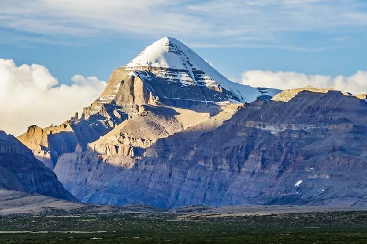
Economically, Lipulekh provides India with the shortest and most direct overland route from North India to Kailash Mansarovar which is Tibet’s holiest pilgrimage site for Hindus. The alternative routes via Nepalgunj–Humla or Kathmandu–Kerung are considerably longer.
For China, the pass serves as a gateway to India’s vast consumer market, making it attractive for bilateral trade. In 2017, during the Doklam standoff, a Chinese Foreign Ministry official provocatively suggested that China might “enter the Kalapani region” as a reciprocal gesture, an implicit acknowledgment of the enormous strategic value India places on the area. Nepal thus finds its sovereign territory serving as a contested buffer zone between two competing regional powers.
What is China’s position on this dispute, and how does it complicate Nepal’s situation?
China’s position has been, at best, unhelpful to Nepal and, at worst, actively contradictory. In 2023, China published its own official national map that did not display the territories of Lipulekh, Limpiyadhura and Kalapani as parts of Nepal, a representation that directly contradicted Nepal’s constitutional map and implicitly sided with India’s position. Nepal’s government lodged a formal protest with Beijing over this cartographic misrepresentation.
More fundamentally, China has consistently treated the Kalapani dispute as a bilateral matter between Nepal and India, declining to support Nepal’s position despite the fact that the Nepal–China Boundary Treaty of 1961 and the subsequent 1963 Boundary Protocol both contain language that, according to Nepal’s interpretation, places the tri-junction at a point consistent with Limpiyadhura being the source of the Kali River.
In August 2025, during the 24th round of Special Representatives’ dialogue between India’s NSA Ajit Doval and Chinese Foreign Minister Wang Yi, India and China agreed to reopen Lipulekh along with two other border trading routes — once again without informing or consulting Nepal.

NSA Ajit Doval (left) and Chinese Foreign Minister Wang Yi (right)
When former Prime Minister KP Oli visited China for the Shanghai Cooperation Organisation Summit in August 2025, he raised the Lipulekh issue with President Xi Jinping and reminded him that Limpiyadhura, Lipulekh, and Kalapani are Nepali sovereign territory under the Sugauli Treaty. China did not offer a substantive response.
Nepali foreign policy experts argue that China’s strategic interest in maintaining stable relations with India and securing access to the Lipulekh trade route outweighs any solidarity with Nepal’s territorial claim. As a result, Nepal is left facing two powerful neighbours that have reached bilateral arrangements over its territory.
What is the Joint Technical Boundary Committee, and why has it failed to resolve the dispute?
The Joint Technical Level Nepal–India Boundary Committee (JTC) was established in 1981, composed of the Surveyor Generals of both countries. Over the course of its work, the committee successfully delineated approximately 98 percent of the 1,880-kilometre Nepal–India border, resolving boundary pillar placements and demarcation questions for most of the frontier. However, Kalapani and the Susta region in Nawalparasi district were explicitly left unresolved and excluded from the committee’s agreed conclusions.
In 2000, both countries agreed at the prime ministerial level to complete field surveys and demarcation of all outstanding boundary areas by 2002. That deadline was never met.
By 2007, the JTC had submitted maps for ratification covering the areas where agreement had been reached, but Nepal has consistently maintained that it will not ratify those maps until the Kalapani and Susta disputes are also resolved. India has repeatedly baulked at substantive discussions on Kalapani, preferring to treat it as separate from the technical boundary process.
Since 2014, a Boundary Working Group has technically replaced the JTC mandate, but it too has focused primarily on the repair and restoration of damaged boundary pillars rather than on the contentious territorial issues.
Currently, 1,240 of the approximately 8,000 boundary pillars along the Nepal–India border are missing or damaged, and there are 31 documented incidents of encroachment along the frontier.
The bilateral mechanism has become effectively stagnant on the most important questions, while India continues to consolidate its administrative grip on the disputed territories through roads, military presence, trade, and pilgrimages.
What diplomatic notes and formal protests has Nepal sent to India and China on this issue?
Nepal has maintained a consistent and well-documented diplomatic record of protest over the Limpiyadhura–Kalapani–Lipulekh issue. In 1991, Nepal formally raised the border issue regarding Indian presence in Kalapani.
In May 2015, when India and China announced the Lipulekh trade agreement, Nepal sent formal diplomatic notes to both governments registering its objection and asserting sovereignty: the first time the expanded claim covering Limpiyadhura was explicitly communicated at government level to both neighbours.
In November 2019, following India’s publication of its updated political map, Nepal issued a strong diplomatic note to India and attached historical records, maps, and treaty documents to support its claim that Limpiyadhura is the origin of the Kali River.
In May 2020, following the Lipulekh road inauguration, Nepal sent another diplomatic note explicitly demanding that India halt all construction, trade, and pilgrimage operations in the disputed area.
In August 2025, Nepal’s Ministry of Foreign Affairs issued a public statement confirming that Limpiyadhura, Lipulekh, and Kalapani “are inseparable parts of Nepal” and sent diplomatic notes to both India and China over the reopening of the Lipulekh trade route.
In May 2026, following India’s announcement of the Kailash Mansarovar Yatra via Lipulekh, Nepal again issued formal diplomatic protests to both countries, reaffirming that the route passes through Nepali territory and that Nepal has “continuously urged” India not to conduct road construction, trade, or pilgrimage in the area.
Nepal has also officially notified China that the Lipulekh region falls within Nepali territory. The diplomatic record is clear, consistent, and extensive although it has so far produced no tangible territorial result.
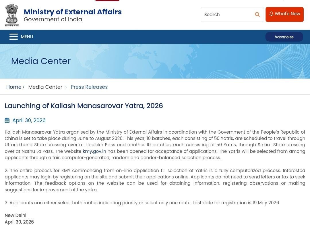
What is the 2026 Kailash Mansarovar Yatra controversy and what exactly has Nepal objected to?
On April 30, 2026, India’s Ministry of External Affairs announced the 2026 Kailash Mansarovar Yatra, scheduled from June to August, to be conducted in coordination with the Chinese government. India planned ten batches of 50 pilgrims each via the Lipulekh Pass route through Uttarakhand, and another ten batches via the Nathu La Pass in Sikkim. The Chinese Embassy spokesperson in New Delhi welcomed the announcement without raising any concern about Nepal’s territorial claims.
Nepal’s government responded on May 3. The Foreign Ministry issued a statement making Nepal’s position unambiguous: Limpiyadhura, Lipulekh, and Kalapani, the territory through which the Lipulekh route passes, are integral parts of Nepal as defined by the 1816 Treaty of Sugauli.
Nepal sent diplomatic notes to both India and China. The Ministry noted that Nepal had “continuously urged” India not to carry out “any activities such as road construction or expansion, border trade and pilgrimage” in the disputed area. Nepal also confirmed it had officially notified China that the Lipulekh region is Nepali territory.
India’s MEA spokesperson Randhir Jaiswal responded on May 3, 2026, rejecting Nepal’s claim as “neither justified nor based on historical facts and evidence” and describing Nepal’s expanded territorial assertions as “untenable.”
He stated that “Lipulekh Pass has been a long-standing route for the Kailash Mansarovar Yatra since 1954” and that the Yatra “has been going on for decades. This is not a new development.” India did, however, reiterate its willingness to resolve outstanding boundary issues through dialogue.
This marked at least the second major such confrontation within twelve months, following the August 2025 trade route dispute and the language from New Delhi was nearly identical on both occasions.
How did Nepal’s 2020 constitutional map change the legal and political landscape domestically?
The 2020 constitutional amendment represented a historic moment in Nepal’s modern political history. The Government of Nepal, under then Prime Minister KP Sharma Oli, released the new political map on May 20, 2020: just days after India’s Defence Minister inaugurated the Lipulekh road.
The map incorporated the entire area east of the Kuthi Yangti River (originating below Limpiyadhura) as Nepali territory, adding approximately 335 square kilometres to Nepal’s claimed domain.
The constitutional amendment to enshrine the new map in Nepal’s national emblem (Schedule 3 of the Constitution) passed with unanimous support across all political parties: 258 votes in favour in the lower house, zero against, and unanimous again in the upper house.
This level of cross-party consensus is exceptionally rare in Nepal’s fractious political environment and reflected a deep national agreement that the territory genuinely belongs to Nepal and that the issue transcends partisan politics.
Legally, the change means Nepal’s territorial claim to Limpiyadhura, Lipulekh, and Kalapani is now constitutionally entrenched. Any future government that attempted to cede or compromise these territories without a corresponding constitutional amendment would face a profound legal and political crisis at home.
The new map is now taught in Nepali schools, used in all official government documents, and printed on the Rs. 100 denomination currency note issued in late 2025.
This normalisation of the claim in official and everyday national life strengthens Nepal’s long-term negotiating position, even as the dispute remains physically unresolved on the ground.
What previous bilateral agreements and diplomatic interactions between Nepal and India have addressed this dispute?
The dispute has been touched upon in numerous bilateral interactions over the decades, though without resolution. The Treaty of Peace and Friendship between Nepal and India, signed in 1950, established the framework for bilateral relations but did not address the Kalapani boundary specifically.
The 1981 establishment of the Joint Technical Level Boundary Committee was the primary formal mechanism for addressing border demarcation, successfully resolving 98 percent of the frontier but explicitly excluding Kalapani.
In 1988, Nepal and India agreed on demarcation of the Mechi River area using boundary markers. In 1996, the Mahakali Treaty formally recognised the Mahakali River as a boundary river, indirectly raising the question of its source.
At a prime ministerial summit in 2000, both countries agreed to complete field surveys for demarcation of all outstanding boundary areas by 2002 but it did not materialize. In 2014, a Boundary Working Group was established to continue the JTC’s work, primarily focusing on pillar maintenance.
Nepal’s Foreign Secretaries and Foreign Ministers have raised Kalapani in various bilateral meetings with Indian counterparts over the years. Following the 2020 crisis, India acknowledged the need for Foreign Secretary-level talks and signalled willingness to schedule them after the COVID-19 situation improved. However, no substantive bilateral dialogue specifically focused on Kalapani has been publicly reported since 2020.
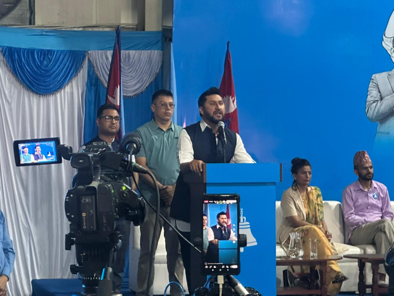
Former Prime Minister KP Oli raised the issue with Chinese President Xi Jinping at the SCO Summit in August 2025. The new government of Prime Minister Balen Shah, which came to power following the RSP’s decisive election victory in April 2026, faces pressure to raise the issue firmly in upcoming meetings with both India and China, and has already signalled its intention to do so.
What are the broader implications for Nepal’s sovereignty and its relationship with India and China?
The Limpiyadhura–Kalapani–Lipulekh dispute carries implications far beyond the 372 square kilometres in question. At its core, it tests whether Nepal’s sovereignty, as a small, landlocked state, can be meaningfully maintained against the competing strategic interests of two nuclear-armed neighbours who also happen to be Nepal’s only land-border partners.
Nepal’s relationship with India is its most consequential bilateral relationship. India surrounds Nepal on three sides, is its largest trade partner, the largest source of foreign direct investment, and a destination for millions of Nepali migrant workers. This deep asymmetric dependency makes it extremely difficult for Nepal to adopt a confrontational posture.
At the same time, allowing India to consolidate control over Nepali territory through roads, military presence, trade routes, and pilgrimage operations sets a precedent that other areas of the Nepal–India border — where 31 incidents of encroachment have already been recorded — are also negotiable.
Nepal’s growing relationship with China adds another dimension. While Nepal has sought to use China as a strategic counterweight and connectivity partner to reduce dependence on India, China’s own bilateral interests with India mean it is unlikely to provide substantive support to Nepal on the Kalapani issue.
China’s 2023 map showing Kalapani as Indian territory was a stark reminder of this reality. Nepal’s core challenge is to pursue its territorial rights firmly through diplomatic channels while maintaining functional relationships with both neighbours: a balance that requires consistent, evidence-based diplomacy, institutional strengthening, and political leadership that places national sovereignty above short-term bilateral comfort.
What is the path forward what must Nepal do to resolve this dispute?
Nepal’s path forward requires a multi-pronged strategy that combines diplomatic firmness, domestic institutional strengthening, and consistent international engagement. Nepal’s strongest assets are its historical and legal case: the treaty text, pre-1857 British survey maps, river science, the Qing Dynasty atlas, and the documentary record all support Nepal’s claim.
The challenge is converting a compelling legal case into a diplomatic resolution against a neighbour that has both the physical possession of the territory and far greater geopolitical leverage.
First, Nepal must insist on resuming substantive Foreign Secretary-level bilateral talks with India specifically on the Kalapani issue, and must not allow the conversation to be deferred indefinitely on procedural or logistical grounds. The Boundary Working Group should be reactivated with a clear mandate that includes Kalapani and Susta. Nepal should formally table its historical maps and treaty documents in every bilateral diplomatic forum.
Second, Nepal should strengthen its physical and administrative presence in areas adjacent to the disputed territory like building roads toward Chhangru, facilitating access for Nepali citizens, and asserting practical governance alongside its legal claim.
Third, Nepal must raise Lipulekh explicitly and consistently in every high-level meeting with both India and China, ensuring both neighbours understand that full normalisation of relations is linked to meaningful progress on this issue.
The RSP government of Prime Minister Balen Shah has already shown awareness of this obligation. Nepal’s constitutional entrenchment of the new map, its currency notes, its school textbooks, and its consistent diplomatic record have all built a strong foundation.
What is needed now is sustained, courageous, evidence-backed diplomacy which is pursued with patience, clarity and an unwavering commitment to Nepal’s sovereign territorial integrity.