Kathmandu
Thursday, June 4, 2026


The statement that ‘Nepal has also encroached upon Indian land’ not only overshadows the progress made through years of efforts to resolve the border issue between the two countries, but also creates a risk of having to restart boundary demarcation work from absolute zero.
KATHMANDU: Nepal’s geographical location is unique. Previously, Nepal shared its borders with China to the north, Sikkim to the east, and India to the south and west. Following the merger of Sikkim into India in 1975, Nepal now shares its border with China to the north and with India on the other three sides.
The boundary treaty with our northern neighbor, China, was signed back in 1961. After the formation of the Nepal-China Boundary Committee and the completion of comprehensive studies, King Mahendra and Chinese President Liu Shaoqi signed the boundary treaty in Beijing. Based on that treaty, surveys were conducted and border pillars were established. Furthermore, according to experts associated with the Department of Survey, both governments form joint teams to update the status of the border pillars, and there are no outstanding border disputes with our northern neighbor.
Meanwhile, on May 31, I heard and read the response given by Prime Minister Balendra Shah in the House of Representatives to a question asked by a parliamentarian regarding the Nepal-India border issue: “I found out only after becoming Prime Minister that not only India, but Nepal has also encroached upon Indian land in many places.” Keeping in mind the ripples generated by the Prime Minister’s remarks, I am presenting a few points based on a study conducted on Nepal-India border relations in collaboration with some friends.
The border with India and historical foundations
According to boundary expert Buddhi Narayan Shrestha, the total border between Nepal and India spans 1,808 kilometers. Out of this, the land boundary covers 1,213 kilometers, while the river boundary spans 595 kilometers. Among the 150 rivers and streams flowing from Nepal toward India, around 60 small and large rivers serve as the boundary line between the two nations. Additionally, at various times, previous governments included technicians from both countries to install border pillars (Junge Pillars) along the land segments as part of completing the boundary work.
To understand the current border between Nepal and India, it is essential to recall and study a few historical documents. The first is the Sugauli Treaty, which was signed on December 2, 1815, and came into effect on March 4, 1816. In my view, this treaty signed between Nepal and the British East India Company is the primary document that must be studied to understand Nepal-India border relations.
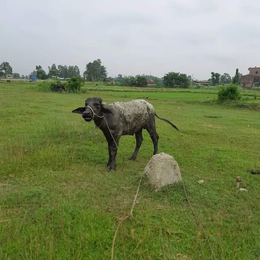
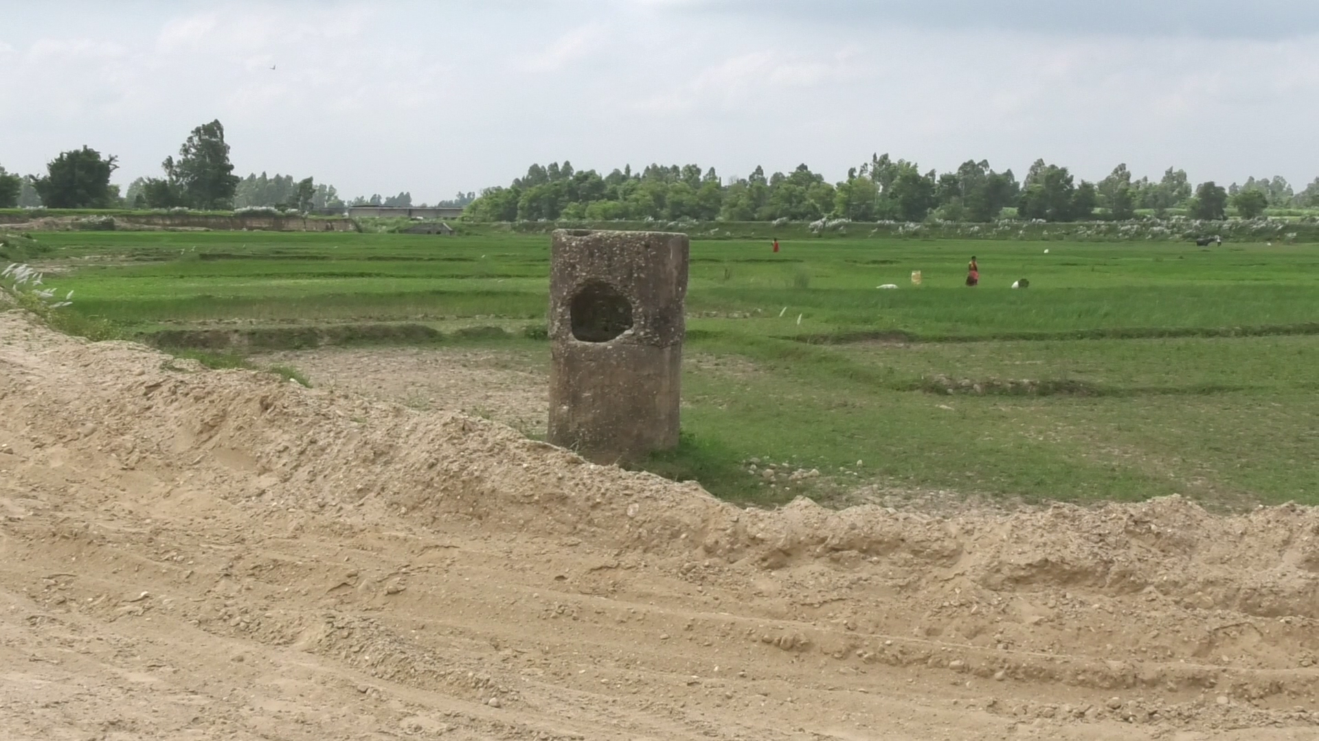
A buffalo tied to the Junge pillar at the international border separating Mahottari and the Motihari district of Bihar state, India, on July 23, 2022. Photo credit: Raghubir Bista
Following that, another treaty was signed with the East India Company in December 1816. Similarly, another treaty was signed in 1860 during the tenure of Prime Minister Jung Bahadur Rana, after which the territories of Banke, Bardiya, Kailali, and Kanchanpur were integrated into Nepal and came to be known as the ‘Naya Muluk’ (New Country). Likewise, another agreement was reached with British India in 1875 to determine the border of the Koilabas region.
All these treaties and agreements determined the shape of Nepal’s present-day border. If any other treaties or agreements exist with our southern neighbor besides these, they too should be made public.
Border mapping
After 1816, both countries formed a joint commission in the Gandak region and prepared border maps. However, the Government of India has raised a dispute over the Susta area in Nawalparasi (Bardaghat Susta West). If the map prepared by the joint team after the Sugauli Treaty had been made an integral part of the Sugauli Treaty, the problem regarding the source of the Mahakali River, in particular, would not have arisen.
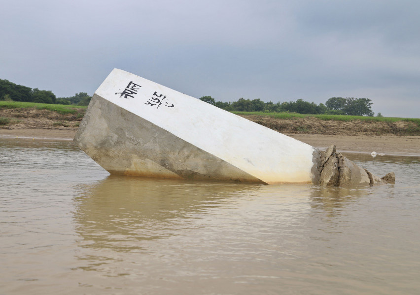
A border pillar knocked down by the river. Photo source: Annapurna Express
Continuous monitoring and necessary border management are required to assess the condition of the installed border pillars, check whether they are missing or require maintenance, evaluate the status of the Dasgaja (no-man’s-land) in the border area, determine the status of the boundary when rivers change their course along river borders, and review cross-border land-use patterns. In the past, this work was carried out every winter by a team comprising representatives from the Ministry of Foreign Affairs, the Ministry of Home Affairs, and the Department of Survey in coordination with relevant officials across the border. It is understood that a Joint Technical Level Boundary Committee, featuring representatives from both countries, was later formed for this very purpose and has been functioning since 1981.
A vital piece of information was made public a few years ago, stating that following years of effort by the Joint Technical Level Boundary Committee, the committee had completed 98 percent of its work. It was also published that 182 ‘strip maps’ had been prepared, lacking only signatures at the government level. These facts were acknowledged by the spokesperson of the Indian Ministry of External Affairs while reacting to the border-related remarks made by our Prime Minister Shah in parliament.
The remaining two percent of the work that could not be completed by the boundary committee involves holding discussions between both sides to determine the source of the Mahakali River, and addressing the issue said to have arisen due to the changing course of the Narayani River in the Susta region. Both countries have entrusted their respective Foreign Secretaries with the responsibility of conducting the necessary studies on these two issues with the assistance of technicians and submitting recommendations to their governments.
Apart from these two major issues, there might be minor disputes in some locations. These include missing border pillars, maintenance of border pillars, removal and clearing of unauthorized structures built on the no-man’s-land, and land-use disputes arising from property spanning across the border pillars. Similarly, the boundary may have shifted here and there due to rivers changing their course. Since the Joint Technical Level Boundary Committee was formed precisely to address these matters, it can easily utilize modern technology to recommend solutions to the governments for the existing border issues.
It has been learned that the Joint Boundary Committee is currently working to remove unauthorized structures on the no-man’s-land and resolve issues related to cross-border land utilization. Once the committee completes its work, the government must strictly implement a policy to disallow any form of encroachment or construction work in the no-man’s-land area.
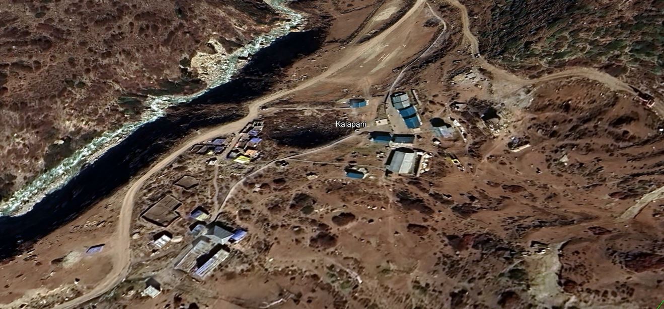
Indian security forces’ camp in Kalapani. Photo source: Google Earth
It was inappropriate for Prime Minister Shah to make remarks on a sensitive issue like the border in the House of Representatives on May 31 without an official note or adequate preparation. His statement that Nepal has also encroached upon India’s land has created confusion. Furthermore, the Prime Minister’s statement undermines the fact that 98 percent of the work has been completed and only two major issues remain. There is a possibility that past technical efforts will be overshadowed. It has also created the risk of having to raise the border issue all over again from the initial stage. This is despite the fact that the Indian side, through its Ministry of External Affairs spokesperson, has already accepted that 98 percent of the work is complete and that issues remain regarding the no-man’s-land and cross-border land utilization. However, India was found to remain silent on the source of the Mahakali River and the Kalapani issue.
On a sensitive matter like the border, it would have been sufficient for the Prime Minister to state that we are seeking a solution through dialogue. However, the statement that ‘Nepal has also encroached upon the border’ has not only weakened Nepal’s claim but has also given the Indian side an opportunity to make counterclaims against Nepal. Some Indian media outlets have even published claims that Nepal has encroached upon 287.33 square kilometers of land. The Prime Minister’s casual remark seems to have played a role in creating such a situation.
‘Map Aggression’ and the Susta dispute
The dispute regarding the Mahakali River is centered primarily on the question of its actual source. Had an official map been attached to the Sugauli Treaty of 1816, such a dispute might not have arisen.
It is worth noting that the British viewed Lipulekh Pass as an important route for trade with Tibet. Therefore, they began altering maps concerning the source of the Kali River to suit their commercial and strategic interests. Until 1856, the main western source was accepted as the origin of the Kali River. However, after 1879, the British unilaterally changed the maps and began showing ‘Turture’ in Kalapani as the source of the river. Disregarding the river boundary accepted by the Sugauli Treaty, the boundary was shifted from the ridges where Turture is located in Kalapani, placing the entire watershed of the Lipu stream on the Indian side.
This interpretation was maintained even after India gained independence from British rule. India had its eyes on the Kalapani region since the early 1950s, and following the 1962 China-India war, India expanded its military presence there due to its strategic importance. As Nepal also neglected the protection of its territory, the Indian side established military barracks there, further strengthening its presence. Recently, India constructed a motorable road up to Lipulekh and opened it for the Mansarovar pilgrimage. Nepal has been registering its objections to this via diplomatic notes.
The Susta dispute is a long-standing issue regarding the Nepal-India border, which is primarily linked to the changing course of the Gandak (Narayani) River. According to the Sugauli Treaty of 1816 and the Roger Martin map of 1817, the central course of the Gandak River was considered the Nepal-India border, and the Susta area fell on the Nepalese side. Later, when the Gandak River shifted its course westward, the Susta region ended up on the eastern bank of the river, and India gradually began expanding its administrative control there. Encroachment and Indian settlements grew rapidly in the Susta-Narasahi (Bhaisalotan) area, particularly after the construction of the Gandak Barrage in Triveni. Nepal has maintained its claim over the Susta-Narasahi area based on historical treaties, maps, and records of the Joint Boundary Commission. According to the principle of a ‘fixed boundary’ prevalent in international demarcation, once a boundary is determined, it does not automatically change even if a river alters its course. However, India argues that the newly modified course of the Gandak should be considered the boundary, and by encroaching upon approximately 4,000 hectares of land in Narasahi-Susta, it continues to stake its claim over it.
The path to resolution
The solution to the remaining disputes regarding the Nepal-India border must not be sought on the basis of emotional reactions or political statements, but rather on the basis of the new map issued by Nepal, historical documents, scientific facts, and international practices. Furthermore, since 98 percent of the work has already been completed, the remaining issues regarding the source of the Mahakali River, Kalapani, and Susta must be finalized through the Foreign Secretary-level mechanism with the help of technical experts. For this, both countries need to make the Foreign Secretary-level mechanism effective, and the heads of government of both nations must issue directives to complete the work within a specified timeframe.
A pillar separating the Nepal-India border in Sirsiya, Parsa. Photo source: Jiyalal Shah
In places where rivers have changed their course, solutions should be sought through studies based on river science (hydrology), whereas for stable landmasses, problems should be resolved based on historical maps and documents. It is important to remember that Nepal cannot and must not forget its new map regarding the sources of the Mahakali. Speaking of the Mahakali region itself, trilateral talks should be initiated between Nepal, India, and China to establish the tri-junction point in the Mahakali area following bilateral negotiations.
It is not that border problems cannot be solved. The most important thing for this is that national leadership must exercise special caution when making statements on sensitive matters like the border. Along with this, they must agree to solve the problem using historical documents, maps, and available science and technology, and direct their talks team to negotiate seriously. If both sides find themselves unable to resolve the issue despite sitting for talks, they must also be prepared to approach international bodies.
Note: Sincere thanks to Prof. Dr. Narendra Raj Khanal and river science expert Dr. Jagat Kumar Bhusal for reviewing the initial draft of this article and assisting in its refinement.
(Dhungel is a former Water Resources Secretary and the author of the book ‘Nepal’s Water Resources in a Catch-22’ [Chakravyuhama Nepalka Jalasrot].)