Kathmandu
Sunday, July 26, 2026





Kathmandu’s streets are flooding after brief downpours because rivers have been narrowed, drainage systems neglected and natural water absorption areas replaced by concrete structures.
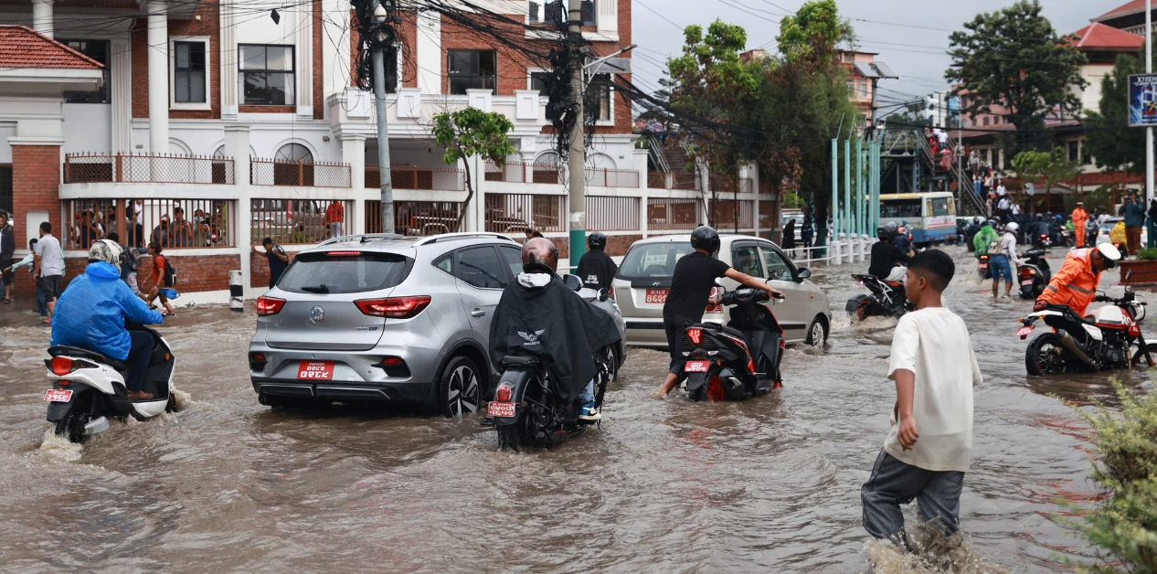
KATHMANDU: The brief rain that fell on the afternoon of July 16 and July 21 inundated Kathmandu’s Maitighar area. As the road turned into a pond, commuters and pedestrians faced immense difficulty navigating the area. While one group of meteorologists described this flooding as an extreme weather event—a result of heavy rainfall in a short span—Shanti Mahat, spokesperson for the National Disaster Risk Reduction and Management Authority (NDRMA) under the Ministry of Home Affairs, argues that the sudden rain is only a secondary factor when it comes to Maitighar. She states that a study led by the authority concluded that the flooding was caused by encroachments on open land, an outdated drainage system, and blockages created by waste such as plastic and clothing. “The flooding wasn’t caused by extreme weather alone; the real issue is the old drains that can no longer handle the water discharge, combined with human encroachment,” she says.
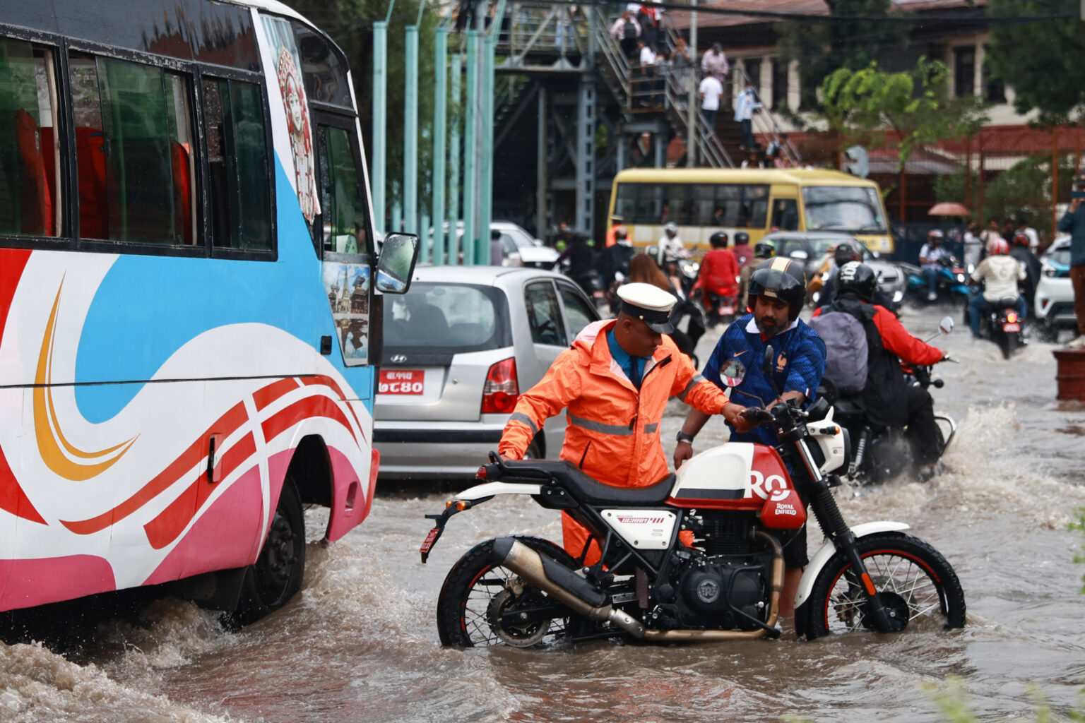
Kathmandu’s Maitighar area submerged after rainfall. Photo: Nepal Photo Library
A technical committee formed under the coordination of NDRMA Under-Secretary Ram Bahadur KC to identify the flooding issues in areas like Maitighar and overall drainage problems in the Kathmandu Valley evaluated the past and present drainage conditions alongside the impact of multi-story construction. The committee conducted a field study on July 22 and submitted its report with recommendations to the authority on July 23. In the case of Maitighar, multi-story buildings such as the District Police Range Kathmandu and the District Government Attorney Office now stand on open lands that previously served as temporary storage and absorption sites for rainwater. Furthermore, the internal sections of the drains are clogged with plastic, clothing, bottles, and other solid waste, obstructing the water flow. On the other hand, maintenance has become difficult because institutions like Thapathali Campus, Rastriya Banijya Bank, and the National Statistics Office have covered the drains within their compounds, while some local residents have covered drains to build shops and toilets. Study coordinator KC explains that due to these human activities, stormwater runoff is trapped, causing streets to flood even during moderate rain. “Across the entire Kathmandu Valley, wherever inundation occurs during the monsoon, the underlying causes are very similar to those in Maitighar,” he notes.
Why does it flood with just a single downpour?
Flooding was once considered a problem exclusive to the Terai-Madhesh region. In recent years, however, the federal capital of Kathmandu Valley—situated at an average altitude of 1,400 meters above sea level—regularly finds itself submerged during the rainy season. Incidents where locals must be rescued using rafting boats in the middle of the capital city are increasing every year.
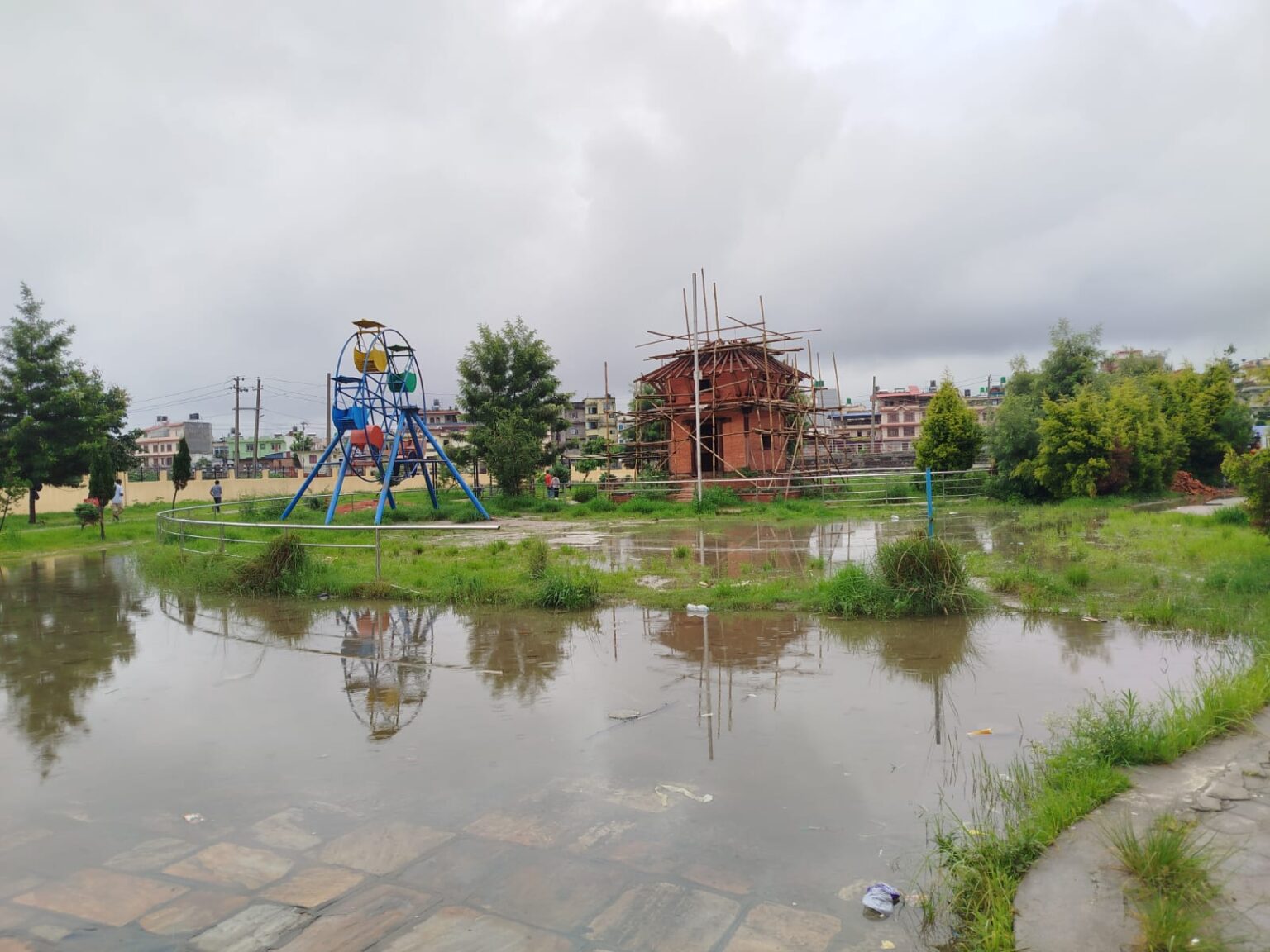
A public park on the banks of the Manohara River in Narephant submerged in floodwater. Photo: Bidhya Rai
In mid-July 2019, when the Balkhu River overflowed, residents in housing complexes such as Kuleshwor Apartment, Oriental Colony, and Metro Apartment had to be rescued using rafting boats. The House of Representatives’ State Affairs and Good Governance Committee monitored and studied the situation. According to the committee’s report, 22 ground-floor flats in Oriental Colony, 17 flats in the adjacent Kuleshwor Apartment, and several flats in Metro Apartment were submerged. The committee concluded that floodwaters inundated the residential areas because the Balkhu riverbank area had been encroached upon during housing construction. In 2022, using satellite imagery and GIS software via Google Earth Pro, this reporter analyzed 95 housing developments, apartments, housing colonies, hospitals, and supermarkets across the three valley districts. The study revealed that 41 percent (39 structures) were built near, partially encroaching upon, or entirely covering riverbanks. Among these 39 encroaching structures, residential complexes including apartments formed the vast majority.
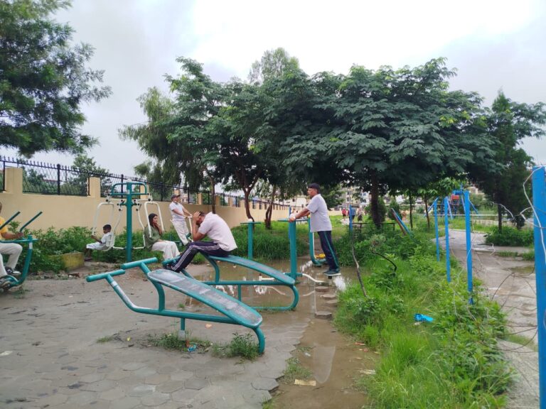
A public park on the banks of the Manohara River in Narephant submerged in floodwater. Photo: Bidhya Rai
Madan Lal Shrestha, former Director General of the Department of Hydrology and Meteorology, says that narrowed rivers and improperly maintained, uncleaned drains simply cannot hold the rainwater, resulting in urban flooding. “For years, under various pretexts like building settlements, connecting roads, or creating parks, rivers and streams have been encroached upon,” he remarks. “Sooner or later, these rivers are bound to reclaim their natural paths.”
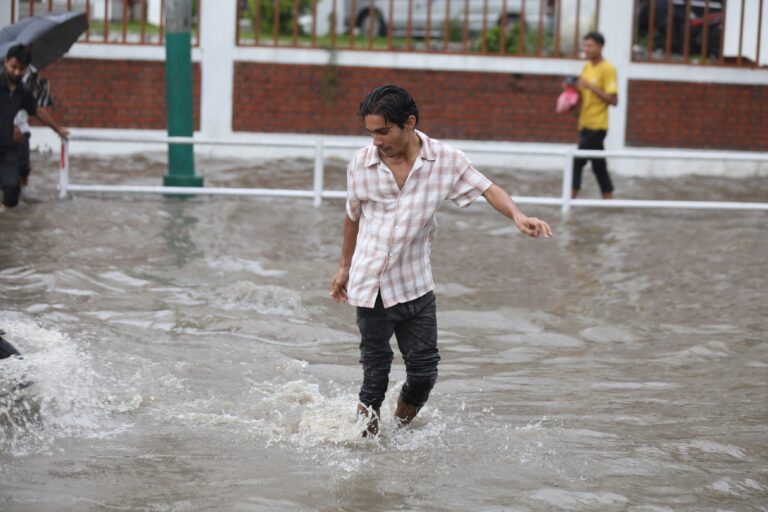
In the past, even during heavy downpours, water would collect temporarily in open fields and farmland and slowly seep into the ground. Because river channels were wide, seasonal runoff flowed away smoothly. Today, those open spaces and farm fields are covered with houses. The remaining land is paved over for roads, drainage ditches, and parks. Because of these concrete surfaces, rainwater no longer lingers or seeps into the soil; as soon as it falls, it rushes into the drains. The drainage water then surges rapidly into streams and rivers. Due to encroachment, the narrowed riverbeds cannot hold the sudden influx of floodwater. Consequently, river flooding spills into nearby residential areas. Meanwhile, poor outlet flow causes drainage water to back up, increasing the risk of urban inundation right in the center of the city. Older drains do not undergo regular maintenance or cleaning, leading to flooded roads and settlements in low-lying areas after a single downpour. Monsoon floods inundate roads, parks, stadiums, hospitals, police stations, and residential sectors. Bridges wash away. Floodwaters have swept away and killed local residents along riverbanks in Kathmandu, while others have gone missing.
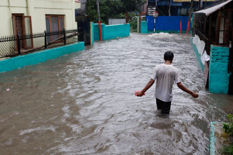
Inundation in Kathmandu-10 following rainfall. Photo: Nepal Photo Library
Floods occurred in Kathmandu as far back as 90 years ago. According to water resources expert Ajay Dixit, a massive flood hit the Bagmati River in 1866, forcing all government offices to close. “Even the ruling king had to move to the Nagarjun Palace for safety,” Dixit says. “This is likely the oldest written evidence of flooding in the Kathmandu Valley.” However, there is a stark difference between floods then and now. Back then, houses were made of mud with tile roofs. Open land was abundant, so even torrential rain was absorbed by the soil. Excess water remained confined within riverbanks. “The entire city did not get submerged like it does today,” Dixit points out.
The burden of unplanned urbanization
Settlement expansion without proper policies, standards, or basic infrastructure is another major factor plaguing Kathmandu Valley residents during the rainy season. This unplanned urbanization has not only created traffic management issues and heightened seismic and environmental risks, but it has also left the valley vulnerable to seasonal floods and inundation. Former Director General Shrestha explains that concrete structures and settlement development contradicting proper land-use concepts cannot withstand the volume of rainwater runoff. “Previously, rainwater had plenty of space to spread. Near rivers, you would first find the river itself, followed by sandy banks, ghats, pathways, farming land, and only then settlements,” he says. “Now, right after the river, you see concrete retaining walls, followed by parks, roads, and then the ghats. Some settlements are literally built on riverbed land.”
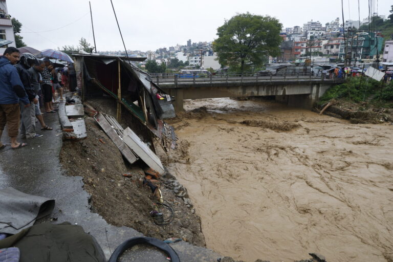
A motorable bridge and road washed away by the Nakkhu River flooding following heavy rainfall in Lalitpur on September 28, 2024. Photo: Gopen Rai
Shrestha points out that UN Park—a popular spot for daily exercise and yoga for residents of Thapathali, Kupondole, Jwagal, Chyasal, Shankhamul, and Buddhanagar—was constructed by encroaching upon the Bagmati River. “If you walk there today, you see roads and wells right past the park. Those wells are proof that the land belongs to the Bagmati River. Historically, wells were dug on riverbanks because water was needed after performing rituals,” he explains. “In the past, the flow width of the Bagmati below UN Park was three times wider than it is now.” In its attempt to reclaim its path, the Bagmati repeatedly floods UN Park. On September 28, 2024, severe flooding destroyed UN Park and swept away the suspension bridge connecting the park to Buddhanagar. Prior to that, floodwaters had also submerged UN Park on the night of August 9, 2022.
Scientific research confirms that rapid, unplanned urbanization is a primary driver behind the rising flood and inundation risks in the Kathmandu Valley. According to a study published on October 16, 2024, by World Weather Attribution titled Rapid Urbanization and Climate Change: Key Drivers of Dramatic Flood Impact in Kathmandu, urban areas in the valley have expanded dramatically.
Between 1990 and 2020, the built-up urban area in the Kathmandu Valley surged by 386 percent. According to the 2021 National Census, the three valley districts—Kathmandu, Lalitpur, and Bhaktapur—contain approximately 800,000 physical structures and a population of nearly 3 million. In 2011, the population stood at 2.5 million; in 2001, it was 907,000; and the 1991 census recorded 598,000 residents. Meanwhile, deforestation in the surrounding areas increased by 28 percent between 1989 and 2019. With average global temperatures rising by 1.3°C, climate-related damages in the Kathmandu Valley have increased by 10 percent, while the frequency of such extreme events has grown by 70 percent. According to climate researcher Manjeet Dhakal, who was part of the study team, climate impacts and their frequency will escalate further now that global temperatures have reached 1.5°C. Thus, rapid urbanization, deforestation, and climate impacts are disrupting the valley’s natural hydrological cycle.
Particularly in Kathmandu and Lalitpur, natural drainage pathways have diminished, elevating the risk of flooding. “During urbanization, water cannot seep into ground that has been paved with concrete, increasing surface runoff to levels that drainage systems cannot manage,” the study notes. According to urban drainage literature, underground groundwater recharge is severely disrupted in urbanized settings. More than half of the rainfall turns into immediate runoff toward streams, rivers, and low-lying areas. This causes sudden flash floods in rivers and inundates surrounding neighborhoods. Soil absorption and evaporation rates plummet. Conversely, in non-urbanized areas, nearly half of the rainfall recharges the ground, 25 percent evaporates back into the atmosphere, and only about 25 percent flows away into rivers. This shift directly leads to loss of life and property in flood-prone zones. The research highlights both unplanned urbanization and climate change as the main culprits behind the valley’s flooding crisis.
Constructing structures over rivers
The Kathmandu Valley is fed by the Bagmati River along with its tributaries: Bishnumati, Hanumante, Manohara, Dhobikhola, Godavari, Tukucha, Nakkhu, and Balkhu. Originating at an altitude of 2,650 meters above sea level, the Bagmati stretches 44 kilometers down to Chobar (Katuwal Daha) at an elevation of 1,140 meters. Virtually every one of these rivers and streams has faced encroachment to some degree. Beyond individual and commercial housing developments, even government-led projects—such as road corridors, embankments, and riverfront parks—have encroached upon waterways, causing annual flood misery to repeat itself, according to former Director General Shrestha.
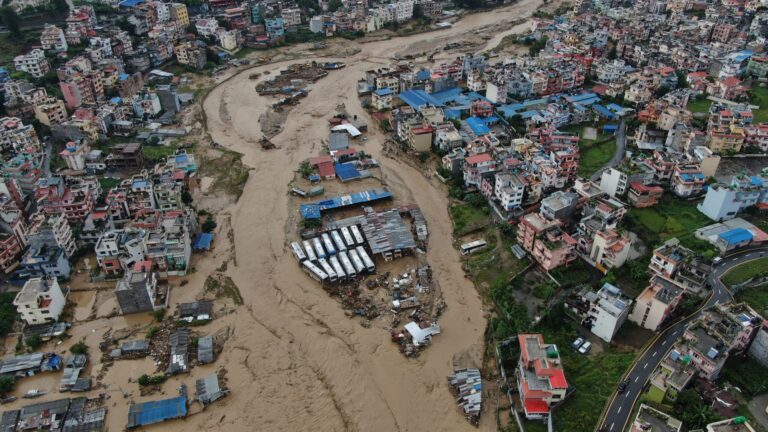
A drone view of flooding and inundation along the Nakkhu River in Lalitpur following heavy rainfall on September 28, 2024. Photo: Gopen Rai
However, Machakaji Maharjan, Project Director at the High-Powered Committee for Integrated Development of the Bagmati Civilization, contends that corridors, embankments, and parks were introduced specifically to prevent further encroachment. “To meet the demands of a growing population, people began building haphazard structures and encroaching on rivers,” he says. “Rivers naturally shift their course over time, and when people started occupying that shifted land, we introduced corridors, retaining walls, and parks to protect the riverfront.”
Urbanization in the valley dates back to 1951, following the advent of democracy, which triggered population growth and raised the demand for water, electricity, housing, and roads. According to environmentalist Hutaram Vaidya’s book Let the Bagmati River Live, excessive sand extraction from the Bagmati began around 1963/64, altering the river’s flow. By 1984, untreated household sewage was being dumped directly into the river. After 1991, landless settlers began establishing informal settlements along the riverbanks.
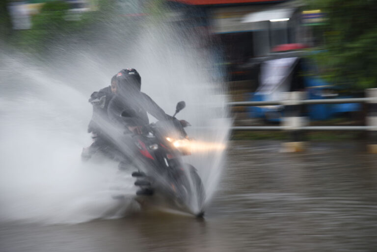
Photo: RSS
As private homes and institutional buildings proliferated along riverbanks, the government introduced a standard in 1993 mandating a 20-meter buffer zone on both sides of the Bagmati, Bishnumati, Dhobikhola, and Manohara rivers. Fourteen years later, the Standards for Construction in Municipalities and Emerging Towns within Kathmandu Valley 2007 maintained this requirement. In 2008, buffer zones for other streams were established: 12 meters on each side for the Nakkhu River; 10 meters for Balkhu, Karmanasa, Kongku, Sangle, and Mahadev rivers; and 6 meters for the Karkhusi stream. Furthermore, it mandated a 4-meter setback for Tukucha, Samakhusi, and other small streams, while completely prohibiting the covering of any natural streams or irrigation canals. Yet, the government itself has failed to strictly enforce these guidelines. Channeling projects under the Bagmati Improvement Project straightened the meandering river course based on 1964 land survey maps, constructing straight embankments, sewer lines, football grounds, parks, road corridors, ward offices, and schools. These government structures narrowed the river, exposing downstream settlements to high flood risks.
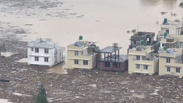
Rescuing residents via helicopter from a colony on the banks of the Nakkhu River after floodwaters entered on September 28, 2024.
According to the International Centre for Integrated Mountain Development (ICIMOD), open space along riverbanks in the Kathmandu Valley measured 0.11 square kilometers in 2010. By 2020, that area had shrunk by 3.63 percent down to just 0.04 square kilometers. Physical construction has continued unabated since, shrinking the Bagmati and other rivers even further. Maharjan acknowledges that flooding occurs in several locations because the rivers lack sufficient land area for natural flow. According to government standards, the river channel below the Bishnumati confluence should maintain a minimum width of 80 meters. Maharjan notes that due to encroachment, the current width in that stretch is only 40 meters. Similarly, in the Tilganga–Shankhamul section, near the Shreenagar Ganesh Temple, standards require a minimum channel width of 30 meters, but this is not being maintained.
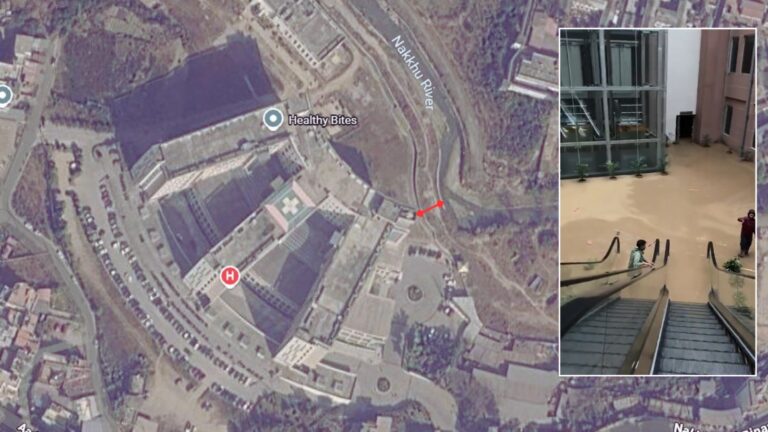
Ground floor of Medicity Hospital in Nakkhu submerged due to torrential rains on September 28, 2024.
Maharjan states that the project aims to widen riverbeds and restore standard flow widths in areas cleared of landless settlers. Additionally, because riverbeds and sewer lines often lie at similar elevations, high water levels cause floodwaters to flow backward into residential areas. He insists his team is actively working to mitigate flooding caused by brief rain events. “We started cleanup and embankment efforts back in 1996, which is how the corridor concept originated. Our ongoing work is guided by hydrological studies that account for climate change and concrete infrastructure impacts.” He claims that around 40 percent of the Bagmati Improvement Project is complete, and once finished, flood risks will be significantly reduced. “Local awareness is also necessary; if a road is flooded for a few hours, commuters should avoid that route and take a detour instead,” he adds.
Former Director General Shrestha counters that road corridors built directly over streams and rivers are generating immense hardship. “While corridors have eased traffic flow across Kathmandu, they have disrupted the natural flow of rivers, forcing rainwater into residential neighborhoods as it seeks an outlet,” he observes.
Water expert Dixit concurs, noting that rivers naturally curve, meander, and spread out. Forcing them into artificially straightened channels to build corridors and parks inevitably leads to disaster.
Hydrological analysis by the Department of Hydrology and Meteorology from 1971 to 2023 shows that while the Kathmandu Valley’s average annual rainfall rate is decreasing by 0.94 millimeters per year, flood risks in downstream coastal zones are rising due to deforestation and urban sprawl in northern hills, according to department hydrologist Souharda Joshi. “In recent years, short-duration high-intensity rainfall (flash downpours) within a single hour has increased, causing severe impacts,” Joshi notes.
Due to dense construction and paved surfaces in northern areas like Tokha, Sundarijal, and Sankhu, rainwater takes virtually no time to reach river channels. Five years ago, even a rainfall rate of 60 millimeters per hour posed limited immediate risk. Rainwater would linger, sink into open soil, and slowly flow toward streams. “Now, everything is paved in concrete. Rainwater quickly pools up and rushes directly into streams, swelling rivers instantly and causing inundation,” he says.
Today, a rainfall event of just 30 to 40 millimeters in the Sundarijal area causes immediate flooding along the Bishnumati and Bagmati rivers. This rapid runoff limits the department’s ability to issue timely flood warnings for downstream residents. As a result, the department now issues flood warnings as soon as heavy rain begins, Joshi explains.
The plight of the drainage system
The official government stance assumes that proper drainage management will mitigate floods and inundation. Agencies such as Kathmandu Upatyaka Khanepani Limited (KUKL), the High-Powered Committee for Integrated Development of the Bagmati Civilization, and local municipalities claim to be actively working on valley drainage. However, the report by the technical committee studying the Maitighar flooding and overall valley drainage issues explicitly concluded that current systems cannot handle even moderate rainfall.
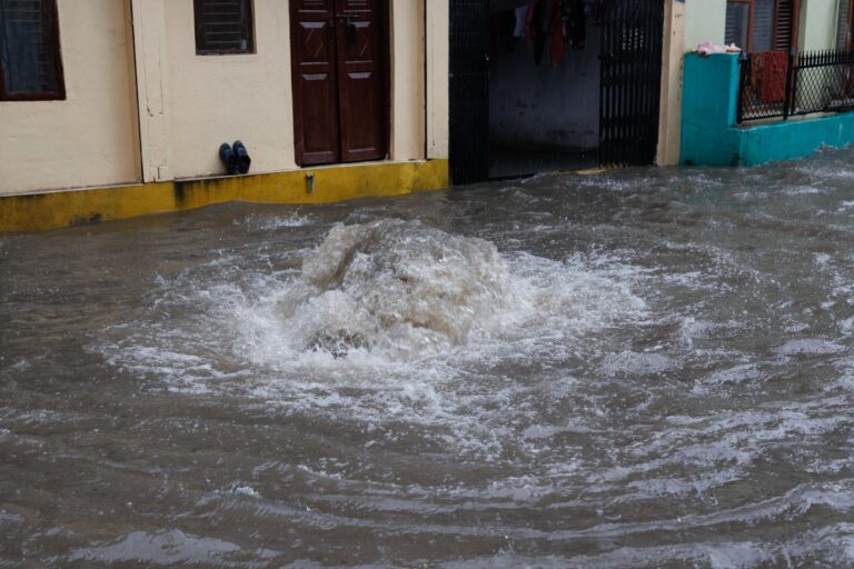
Due to a lack of regular maintenance, upgrading, and cleaning, old drains experience blocked water flows, causing sewage to back up through pipes and onto the streets. Additionally, public and private structures have been built directly over drainage outlets in several areas. The committee noted in its report that structures built over drains by Thapathali Campus, Rastriya Banijya Bank, and the National Statistics Office make inspecting internal drainage lines extremely difficult. In Maitighar, neglect in regular cleaning has allowed plastic, clothing, bottles, and solid garbage to accumulate inside drains, choking off the water flow. “When flow is blocked, water that should run through the sewer backs up onto the road even during moderate rainfall,” explains committee coordinator KC.
The committee recommended establishing effective coordination among the Nepal Electricity Authority, Nepal Telecom, KUKL, Project Implementation Directorate, Kathmandu Metropolitan City, Department of Roads, and Traffic Police during infrastructure projects to keep drainage channels clear.
Former Director General Shrestha also emphasizes that poor drainage management directly exacerbates monsoon flooding, while relevant government agencies remain uninformed. “If we could upgrade old drainage systems to handle current flow capacities and make them durable, urban inundation could be reduced significantly,” he says. “However, there is no proper record of existing drains; government agencies often don’t even know where certain drainage pipes are located or what condition they are in.”
Prakash Kumar Rai, spokesperson and manager at KUKL, maintains that drainage management work is ongoing. “It’s not that work isn’t happening,” he says. “With houses and paved asphalt everywhere, all surface runoff gets directed into rivers. Drainage pipes built years ago are simply too small to handle current runoff volumes, leading to inundation.” He adds that problems also arise when local consumers expand drainage lines on their own initiative. Rai notes that making the valley’s drainage fully effective is beyond KUKL’s current capacity and resources alone. “The federal government, urban development experts, and stakeholder agencies must coordinate to upgrade the entire drainage system,” he says, adding that damaged lines are repaired regularly as part of ongoing operations.
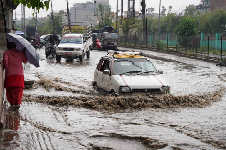
Traffic affected by accumulated water in the Kankeshwari area along the Bishnumati Corridor road in Kathmandu Metropolitan City-19. Photo: Nepal Photo Library
Maharjan, Project Director at the Bagmati Committee, considers high population density and concrete paving to be normal urban features. Rather than blaming urbanization itself for flooding, he advocates for strict enforcement of riverfront setback standards. “If we simply enforce river buffer standards, we can minimize flood and inundation risks to a great extent,” he claims.
Hydrologist Joshi stresses that to prevent urban flooding, drainage systems must be upgraded to withstand current rainfall intensities. “We urgently need to build drainage infrastructure capable of handling localized, high-intensity downpours that fall within a single hour,” he concludes.