Kathmandu
Tuesday, July 7, 2026





Rising water levels and changing river paths threaten the historical Setiveni Shaligram and vulnerable coastal villages in Mustang, highlighting the urgent need for scientific river management
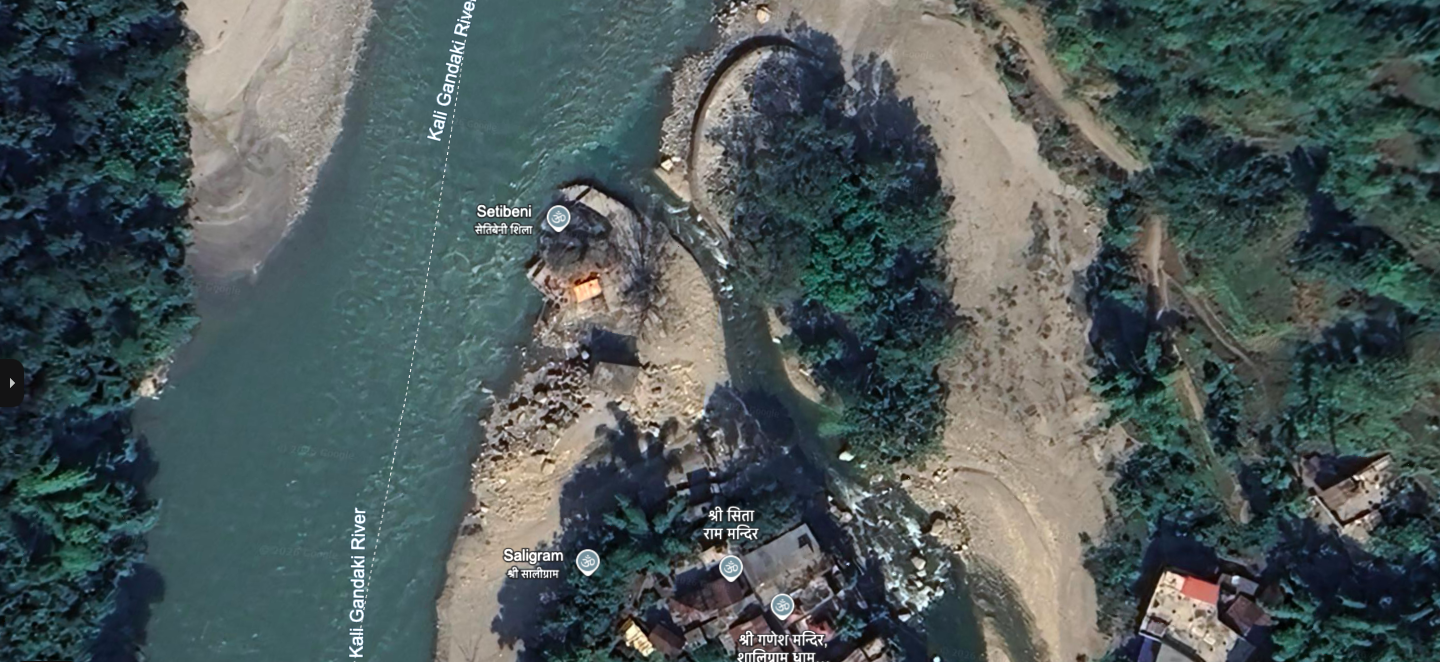
KASKI: Setibeni Shaligram, a sacred rock of immense religious and geological value at the confluence of Syangja, Parbat, and Gulmi, has become impossible to fully circumambulate since 2019 due to the changing course and rising levels of the Kaligandaki River.
However, as the water level of the Kaligandaki has been rising in recent years, some parts of the rock have started to submerge in water. The course of the river has also changed. According to locals, it has not been possible to circumambulate the rock like before for the past four years.
Sundari Puri, a resident of Bihadi Rural Municipality in Parbat, says she has seen the changing form of the Kaligandaki with her own eyes.
“Previously, people used to walk around the Setibeni Shaligram to worship, but now it is not possible,” she says, “There is no space to go completely around at all. It has changed; one cannot say it hasn’t.”
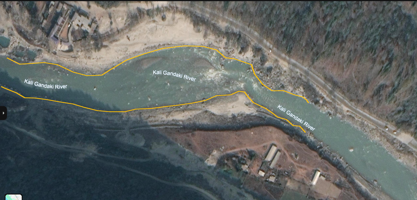
In old images from Google Earth, a large part of the rock appears separate from the water until before 2017. However, in images from recent years, some parts of the rock are seen falling within the river’s surface. Locals interpret this as a consequence of the exploitation of the Kaligandaki. Geologists, however, state that the changing form of the river is linked not only to excavation but also to natural processes, the amount of debris, and the river’s balance.
Allegation of exploitation
Laxman Puri of Bihadi Rural Municipality in Parbat says that the old form of the Kaligandaki no longer exists. According to him, the river has changed its course in some places, the surface has deepened in some, and piles of stones and gravel have increased in others.
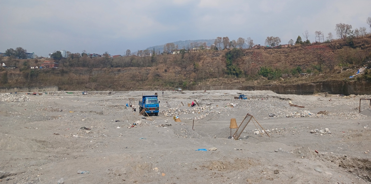
The heavy use of large excavators to dig deep trenches has completely disfigured the Kaligandaki River, leaving it looking utterly devastated.
“The old form of the Kaligandaki is gone. In some places there are piles of stones, and in some places, the direction itself has changed due to the extraction of gravel and stones,” Puri says. He alleges that illegal excavation has spoiled the natural form of the river and neighboring areas are at risk.
Yagya Thapa of Jaljala Rural Municipality-7 in Parbat also holds a similar view. He claims that the excavation of riverbed materials from the Kaligandaki has become uncontrolled. “The natural form of the river has been made extremely ugly,” he says, “The heavy use of large excavators to dig deep trenches has completely disfigured the Kaligandaki River, leaving it looking utterly devastated.”
When the debate on the conservation of the Kaligandaki arises, the issue of the changing form of the river comes up repeatedly. However, a concrete study on whether the main reason for such change is uncontrolled excavation or the river’s natural process has not yet been conducted.
River filling with debris
Geologist Shri Kamal Dwivedi says that the changing form of the Kaligandaki cannot be understood merely by linking it to exploitation. According to him, how much debris the river brought down from the upper section, and where and how it accumulated, can also change the course and surface level.
An example of this can be seen in Mustang. Some villages on the banks of the Kaligandaki have fallen into risk as the river surface continues to rise. According to locals, as riverbed materials kept piling up, the surface of the Kaligandaki has risen by about seven meters in some places over the past 10 to 20 years. Due to the rising surface, coastal settlements in Mustang, including Chaire, Jomsom, Kagbeni, Eklebhatti, Syang, Marpha, and Lete, are at risk.
During the monsoon season, the river not only erodes arable land but has also increased the fear of floods entering settlements. Mustang falls within the Annapurna Conservation Area. Section 16 (C) of the Conservation Area Management Regulations, 1996, prohibits mining or extracting stones, soil, minerals, and other materials inside the conservation area.
However, according to Dwivedi, it does not mean that riverbed materials should not be extracted in all places. To maintain the balance of the river, in some situations, it may be necessary to scientifically extract the debris coming from above. “The Kaligandaki is a large river; it brings a lot of debris,” he says, “How much has arrived and how much needs to be extracted should be determined through a study. If it is not extracted, the river may keep getting buried, and the course may change.”
According to Dwivedi, the problem is not just whether to excavate or not, but how much, where, and how to do it. Heavy excavation can also change the river’s course and increase erosion. Likewise, if the necessary debris is not removed, the river can get buried and flow toward another side.
“Even if dug too much, the river can change, and even if the river is buried, it can go to another side,” he says, “What is happening in the Kaligandaki can only be told after conducting a study.”
Excavation without study
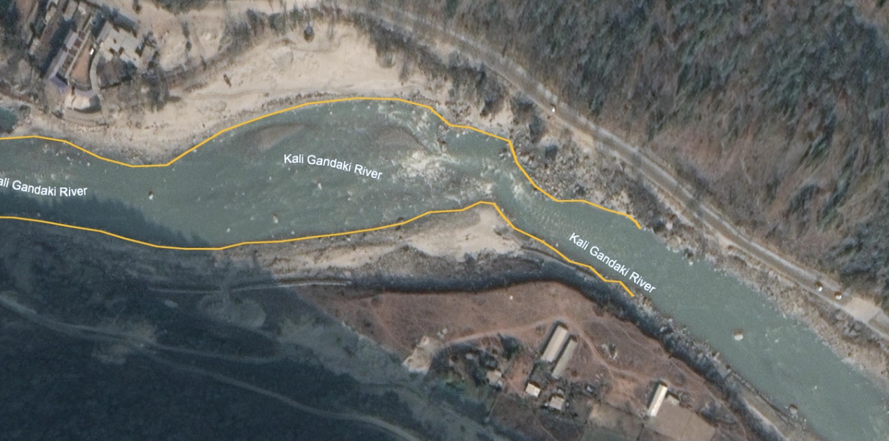
The shift in the flow of the Kaligandaki can be seen in Sahasradhara of Parbat. In Google Earth images, the river that used to flow through the middle of the two banks in 2019 is seen moving toward one bank by 2023. Riverbed materials are now seen piled up where water used to flow previously. Locals claim that a crusher industry is operating right next to the river in the same area.
According to the District Coordination Committee, four crushers are registered and operating in the district. Apart from those, temporary crushers are also operating for various projects.
Dwivedi says, “It is neither a matter of letting someone extract limitlessly nor is it a matter of not letting them extract at all. Decisions must be made only on the basis of scientific studies. In our case, the practice of working after conducting such studies is weak.”
Path for contract opened after court
After a writ was filed in the Supreme Court against Kaligandaki excavation, the court issued an interim order on July 13, 2021, ordering the stoppage of all works related to river excavation. Following that, local units were unable to lease out riverbanks on contract for a long time.
However, on October 27, 2024, the bench of Supreme Court Justices Dr Kumar Chudal and Binod Sharma dismissed the writ. Nevertheless, the court issued a directive order to make the water utilization, as well as the excavation, consumption, and distribution of stones, gravel, and sand from the Kaligandaki River, more systematic, predictable, and effectively monitorable and to arrange for punishing offenders.
The path to call for tenders for the excavation of riverbed materials opened following the court’s order. After that, local government units have started leasing out riverbanks on contract. Officials claim that this has increased the income of the local units. However, they say it will take time for the entire amount from the contracts to be collected.
Claim of monitoring
The role of local government units and the District Coordination Committee is crucial in the conservation of the Kaligandaki. The responsibility of contracting, excavating, and monitoring riverbanks lies mainly with the local levels. The District Coordination Committee also plays a monitoring role.
The Chief of District Coordination Committee Parbat, Bishnuram BK, says that monitoring is being carried out as required for the conservation of the Kaligandaki. According to BK, contracts had been stopped for a long time after disputes arose over the excavation of riverbed materials. Following the court’s latest order, local levels have started awarding contracts based on environmental impact assessments and monitoring. He claims that after this, incidents of illegal smuggling have decreased and the income of local levels has also increased.
“Previously, there was a tendency to exploit illegally. Now, even when extracting through a system, there is a negative perception that it was ‘stolen,’ he says, “The fact that the form of the Kaligandaki has changed is not necessarily due to exploitation alone. Sometimes, when a big flood comes, the river can leave one place and move toward another. There is no major problem right now.”
However, the experience of the locals, the changes seen in satellite images, the directive order given by the court, and the warnings of geologists point to the need to manage the Kaligandaki, which has changed to the extent of threatening surrounding settlements based on scientific studies.